Date: 20180518
Time: 9:35 – 18:20
Distance: 27.7 km
Stay: Blair Lodge, Combe Martin
Walk
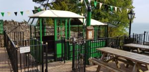 Today starts well, I save myself the first climb by going up the Clif Railway (from Lynmouth to Lynton). For that I have to wait a bit, the Clif Railway is only open at 10:00 am I hear from the people who work there. I chat with the employees / volunteers for a while and learn that the Clif Railway does not use any electricity. Everything is done with water from the river that flows on top of the hill. There are two trains and they are connected. If one train has to go up, then its water tank is emptied, the water tank of the other train has already been filled by then. Simple, effective and very green!
The remaining fifteen minutes I have a look around in the harbor of Lynmouth.
Since there is still enough to climb today, I do not even feel guilty about skipping this climb 🙂
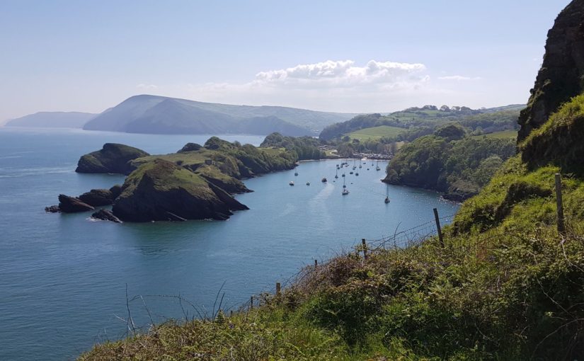
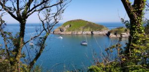
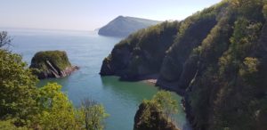
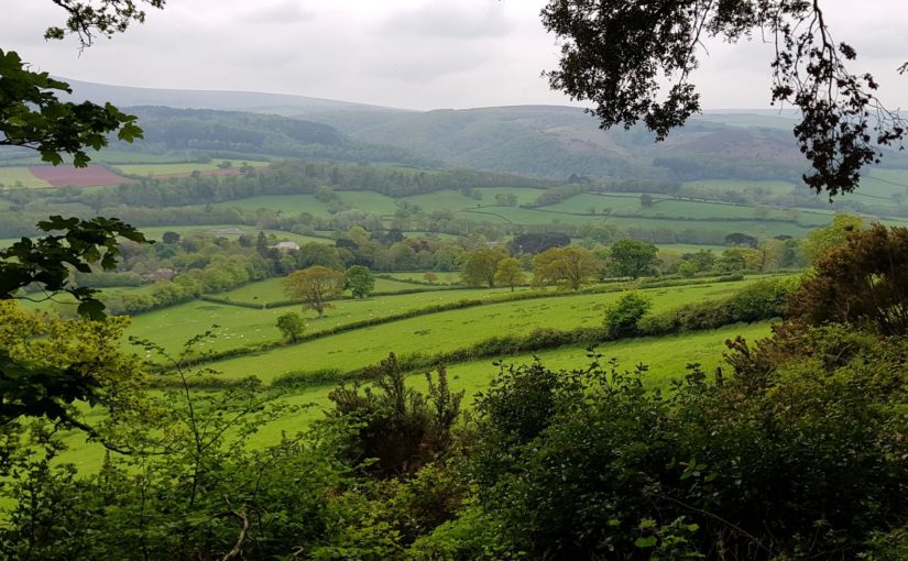
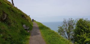 After that the path goes along the hills and along the sea. There are a lot of walkers here. But the crowd is getting less after a while. I arrive at the Valley of Rocks. Here I go up to enjoy the view. Then the path continues past Lee Abbey. The path now runs along a road, but there is an alternative route more closely to the coast and through the meadows. Of course I choose this.
Just before I switch to the alternative route, I meet three other hikers. We chat for a while and then they continue via the road and I follow the alternative route. The alternative route is much more fun (and much heavier) than the route via the road. I walk through grassland with sheep and through small paths along the coast. After some time I return to the road again. I keep following this for a while until I go back into a path that eventually goes down.
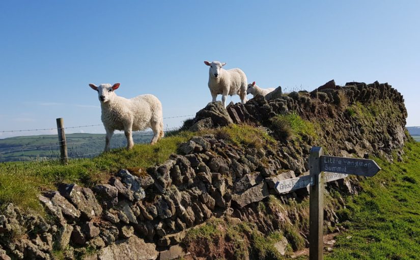
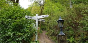 At the bottom, there is a sign indicating the directions to America, Russia, Iceland and New Zealand. Here I meet the three hikers again and we have a chat and the some jokes about the signpost. Then I continue, they have a slightly slower pace. Later I will meet the three musketeers again.
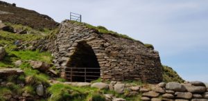 After quite some time I arrive at Heddon Valley. Here I first walk to Heddon Beach. There is an ancient lime kiln on the beach. When I am back on the path, I meet the three musketeers again, they are resting on a bench. We have another chat and then I continue to the Hunter’s Inn. I follow the river, the Heddon, and after a small detour (the path to the inn is closed because a big tree has fallen down or is cut down) I arrive at my resting place.
Here I take a pint and a well-deserved half-hour of rest. At another table there is a hiker who I met several times yesterday and today. When she leaves, she comes over to have a chat. She does circular walks every day because she wants to get back to her car again. She now goes back to Lynmouth, via a different route.
After my rest, the walk continues. I walk back to the path via a different route. Then it goes up steeply, around Peter Rock. This is a reasonably dangerous part, the cliff goes down steeply and the path is very narrow. I continue walking along the hill on a narrow path with shrubs to the left and the hill that goes uphill and to the right the hill going down. After the path goes inland, I walk past meadows on a somewhat wider grass path. Occasionally I walk through the meadow because the path is no longer passable. Here, too, diversions are arranged.
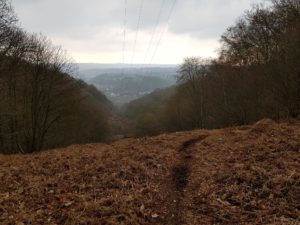
 Eventually it goes all the way down again. I cross a stream and after that it goes up steeply, as usual, to Great Hangman this time. Fortunately, the steep stretch does not last too long and the rest of the climb to Great Hangman goes much more gradually. Great Hangman is the highest sea cliff in England and thus also the highest point on the South West Coast Path (318m).
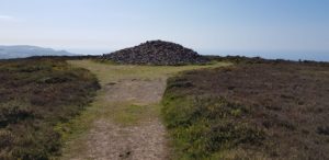
Just before I reach the top, I meet the three musketeers again. We chat again and I continue to the top. At the top, I find a cairn, a large stack of stones, but unfortunately no bench (you do find everywhere else). So I sit and rest on the pile of stones. I think I deserved a rest after this climb. The three musketeers pass by and during the descent of Great Hangman we walk more or less together. More or less, because everyone does everything at his own pace.
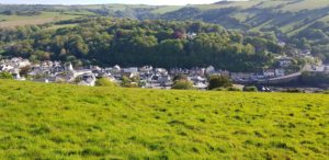 The descent is pretty heavy. I feel my left knee protesting. In the end, however, we all end up in Combe Martin. Now quickly to the B & B for a shower and then into the village for something to eat.
The route today was pretty tough. I have done a number of extras, but not everything. All in all, I walked a good 27 kilometers again.
In the evening I meet the three musketeers again at the Dolphin Inn, where I’m going to eat. Here we have more time to chat and that is what we do.
Weather
Today it was again great weather, sunny and sometimes even a bit too hot. I had put on my thin jacket again and again I took it off pretty quickly and put it in my backpack. Later on, however, I put it on again to avoid sun burn.
Lyric of the day
In honor of the highest point of the South West Coast Path, the Great Hangman, today the lyrics are Gallows Pole by Led Zeppelin:
Hangman, hangman, hold it a little while,
I think I see my friends coming, Riding many a mile.
Friends, did you get some silver?
Did you get a little gold?
What did you bring me, my dear friends, To keep me from the Gallows Pole?
What did you bring me to keep me from the Gallows Pole?
I couldn’t get no silver, I couldn’t get no gold,
You know that we’re too damn poor to keep you from the Gallows Pole.
Hangman, hangman, hold it a little while,
I think I see my brother coming, riding many a mile.
Brother, did you get me some silver?
Did you get a little gold?
What did you bring me, my brother, to keep me from the Gallows Pole?
Brother, I brought you some silver, yah
I brought a little gold, I brought a little of everything
To keep you from the Gallows Pole.
Yes, I brought you to keep you from the Gallows Pole.
Hangman, hangman, turn your head awhile,
I think I see my sister coming, riding many a mile, mile, mile, mile.
Sister, I implore you, take him by the hand,
Take him to some shady bower, save me from the wrath of this man,
Please take him, save me from the wrath of this mad man.
Hangman, hangman, upon your face a smile,
Tell me that I’m free to ride,
Ride for many a mile, mile, mile.
Oh, yes, you got a fine sister, She warmed my blood from cold,
She brought my blood to boiling hot, To keep you from the Gallows Pole, Pole, Pole, Pole, yeah, yeah
Your brother brought me silver, Your sister warmed my soul,
But now I laugh and pull so hard And see you swinging on the Gallows Pole, yah
But now I laugh and pull so hard And see you swinging on the Gallows Pole, Pole, Pole
Swingin’ on the Gallows Pole! [x3]
Swingin’ on the Gallows Pole, Pole, Pole, Pole, Pole, Pole, Pole, yeah
Photos

 Up to Ilfracombe the route is not too hard, not too much climbing and fantastic views. I cross a campsite among other things. Also in this first part there are plenty of possibilities to get something to drink (or eat).
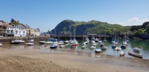 Ilfracombe is full of tourists. Still, I find a quiet terrace (at the back of the restaurant) with a nice view of the sea.
 The part after Ilfracombe is quite heavy again. Not because of the altitude, but because of the many falls and rises. Eventually I arrive at Morte Point, a rock formation that protrudes into the sea. From here the beaches of Woolacombe are clearly visible. It is not very far anymore to Woolacombe. That last part, however, is still quite hard because it is going up steeply before I am on the road and then it goes down again.
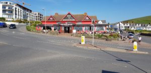 At the end, however, the Red Barn Inn (very very red) waits with a nice selection of beers …
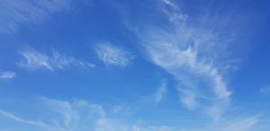 Today it was again great weather, sunny and sometimes even a bit too hot. Somewhat the same as yesterday, only slightly warmer. No jacket needed today.


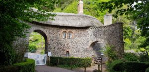 Worthy Toll House, a beautifully designed toll house that has been preserved very well.
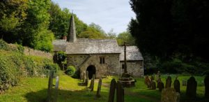 Culbone Church, one of the smallest churches in England (10.5 x 3.6 meters) where regular services are still being held. Around the church is an old cemetery. This looks great.
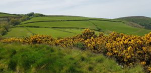 Sugerloaf hill, a small diversion with a very nice view. Here I have a break to eat and drink and to enjoy the view.
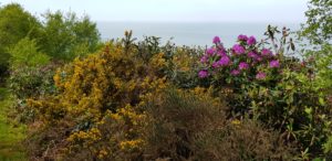 Rhododendrons, to the yellow gorse, the purple Rhododendron joins at one point. Not an occasional shrub, but whole mountain slopes. A great view with all those colors.
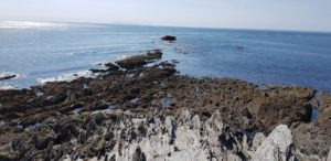
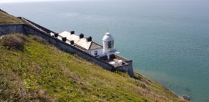 Foreland, here at Devon’s northernmost point there is a lighthouse and of course I walk there. Further on there is also a possibility to walk to the top of the hill. From here there is a great view in all directions.


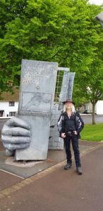 Then back to the beginning of the path. Here I ask another hiker if he wants to take a picture of me and the sculpture. This is more or less obligatory when you walk the South West Coast Path 🙂
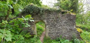 Once back on the path, it goes up a little further to North Hill Viewpoint. Here I have a nice view. Just a pity that it is very cloudy.
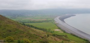 At the top, I meet a Danish woman who is listening carefully. She makes recordings of the tides and is looking for the best point to do so. We chat for a while and after I walk a bit further to the rocky point, I go down through the bushes on a very steep path. The path is so narrow and overgrown that I regularly doubt whether there is a path at all. But every time a route shows as I continue.
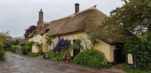 Eventually I end up on the South West Coast Path again. The next part is a relaxed track along a small stream. At Bossington I cross the stream and it’s time for a break at the famous
 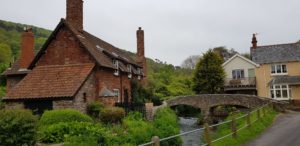 Because I am in Bossington well in time, I decide to do an extra walk inland to Allerford and Selworthy. This is also a very nice route with nice views on the hills in this area. Both villages are very small and picturesque with a number of nice cottages. In Selworthy I walk to the church with a very old cemetery. Most tombstones are hardly or not legible anymore.
 On the outskirts of Bossington, at Bossington Farm, I buy a bottle of natural apple juice at the side of the road. My water starts to run out and natural apple juice seems a nice replacement to me. It actually is and the next few miles I empty the bottle.
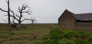 The next miles go through the Marsch, an area that regularly floods at high tides. This is actually a little boring. However, there are some impressive dead trees. Eventually I come all the way to the coast and there the path goes over stones. This is not nice walking and I am happy when I can go up to the road.
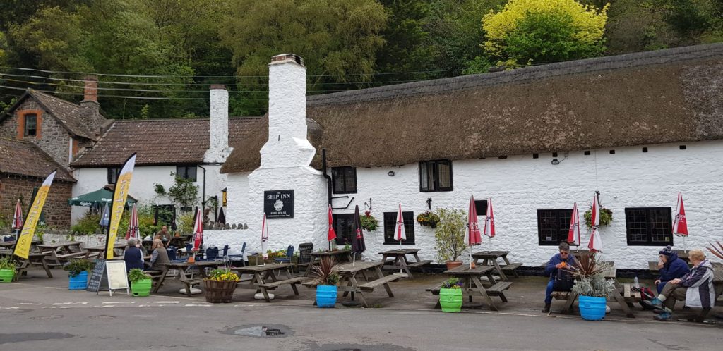 Just a little bit further along the road and I reach Porlock Weir. I’m looking for


 We take bus 94 to train station Liège Guillemins. Our intention was to then take the train to Bressoux. However, the connection is very bad (almost an hour’s wait) and Frank suggests to look for a bus. This is possible, we take bus 138, only a 10 minutes wait.
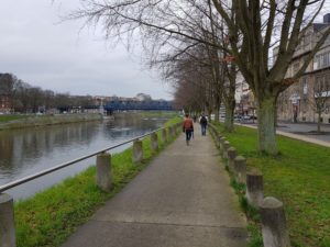
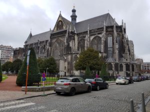 When we reach station Bressoux, we continue to the city towards the Meuse. We follow the Meuse for quite some time. On the other side is the Liège market, but we are not going there today. At Église Collégiale Saint-Jacques the first route ends and a new route starts.
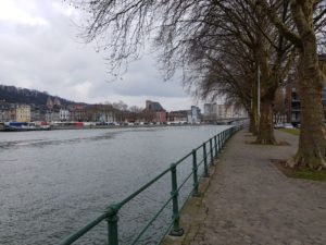 Unfortunately we don’t find anything to get a coffee, only one restaurant at a marina is open, but we do not get coffee there (all tables are reserved for the Easter brunch). The waiter gives us directions where we can get coffee, but this would mean walking back too far. We take the risk and still hope to find something.
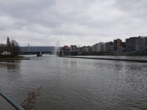 We continue through Liège, walking along the Meuse, until we reach the mouth of the Ourthe. Now we follow the Ourthe for a bit. When we leave the Ourthe, we go in the direction of Angleur, a suburb of Liège. To our pleasant surprise we find an open pub here, La Drash. Here we take a drink (the time for coffee has passed), after almost 11 kilometers.
 The break was just in time, when we walk out of Angleur (after one street), we immediately walk into nature and the forest. We do not really leave the countryside anymore until we reach the end of our walk.
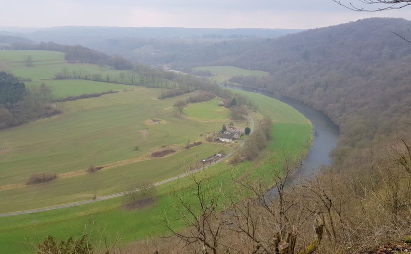
 We have been following the markings of the pilgrim path, the shell, for a while. At one point, however, we deviate from the pilgrim path, down a narrow path. We continue down until the bottom of this valley comes into view. A small stream flows through the valley. According to our GPS route, we have to cross that stream at some point. However, there is no bridge and even worse on the other side the path is still a lot higher and we have to climb through the bushes on a very steep slope to reach that path. We do not let this stop us and all three of us reach the path on the other side.
 Unfortunately, the path is very bad, it is used by mountan bikers and there is a lot of water and mud. Fortunately, more people have apparently walked here, because there is some sort of alternative path on the side. Eventually we have to climb straight up across a field with dried plants to get back on the pilgrim path. If we had just walked on, we would also have come to this point …
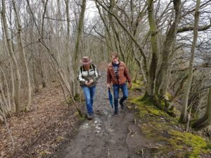 After more forest we cross a highway and now we climb up a hill and follow the ridge via a rocky path. It is also quite slippery because of the mud, so we have to watch out. After a while, on the left we have a great view over the Ourthe valley.
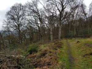 When we leave the forest, the route is following paved roads. We walk into Neupré, but we are still far from our car. We eventually arrive there. Unfortunately there are, again, no opportunities to have a drink at the end of our walk, even in Neupré.
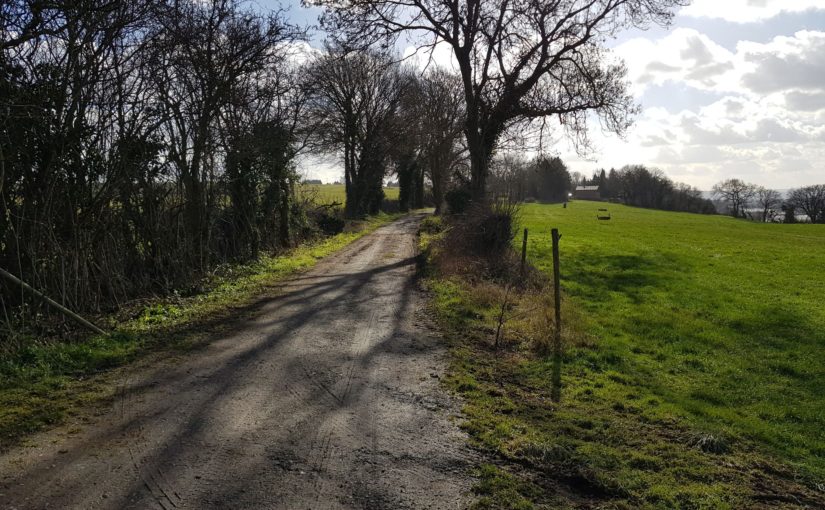
 The first route we are going to walk is from Maastricht to Reims.
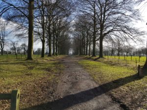 Just after 9:00 we start our walk that begins near the train station along the Meuse. We will continue to follow the Meuse largely today. First in Maastricht and then outside of Maastricht through parks and fields.
 We suspect that the rest of the trip may be disappointing because we will be walking though Liège and this is rather industrial and dirty. However, we are pleasantly surprised when we instead walk over the hills a short distance from the Meuse, in the middle of nature, through forests and later through fields. A very nice environment.
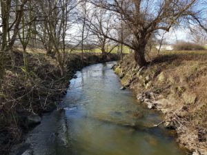 In Jupille-sur-Meuse we enter Liège and then we walk through the urban area (not the most beautiful part of the route) to Bressoux. Unfortunately, there is no pub or anything like that. So we have to wait until tonight for a well-deserved beer on the couch.
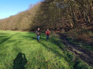 We have a smooth journey back home, with coffee and Cola from the Kiosk in Maastricht.
 We walked the following routes:
 Weather