
Date: 20180623
Time: 9:50 – 16:45
Distance: 21.8 km
Stay: Bridgeside Guesthouse, Looe
Walk
 Today I walk to Looe, where Ada, the kids and I went on holiday in 2009. But first I have to take the ferry from Fowey to Polruan. This goes fortunately every 15 minutes and when I arrive at the quay, it is already coming.
 Then it goes to Polperro. It goes up and down to Polperro and occasionally quite steep.
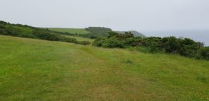
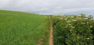
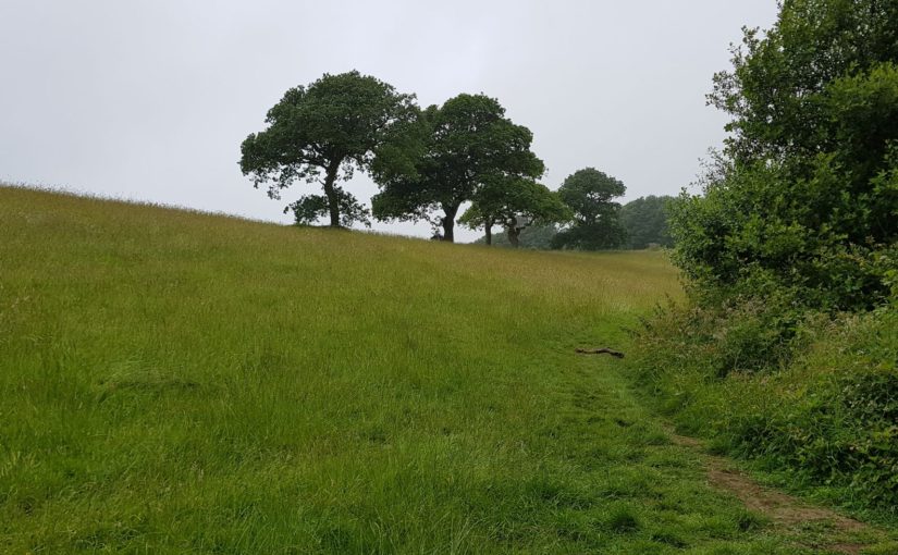
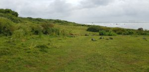
They are making a fence around a meadow. One of the workers warns me to stay on the path because otherwise I get stuck. The route through the meadow seems indeed easier, but at the top the fence is already finished and you can indeed not get back to the path.
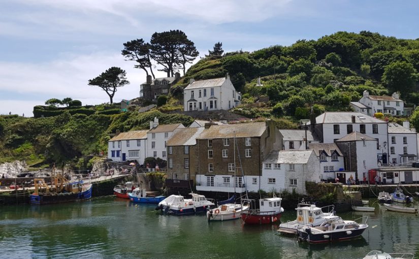
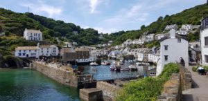 Polperro is again such a village that you only see at the last minute. An ideal opportunity for a break, there is a life band on a stage. So the break will be in the neighborhood in the pub so that I can hear the music, I go for the Blue Peter Inn. A good beer and life music.
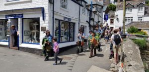 If I go further, I run into a procession. Everyone dressed as a pirate, a kind of brass band in the front and even more musicians at the back. I wait until they have passed and then go on again.
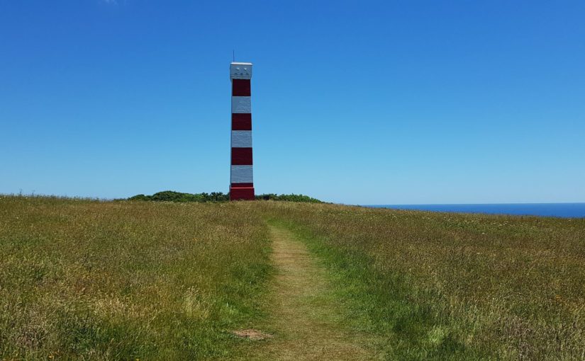
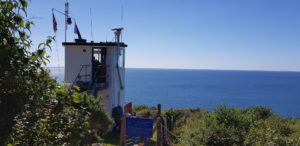
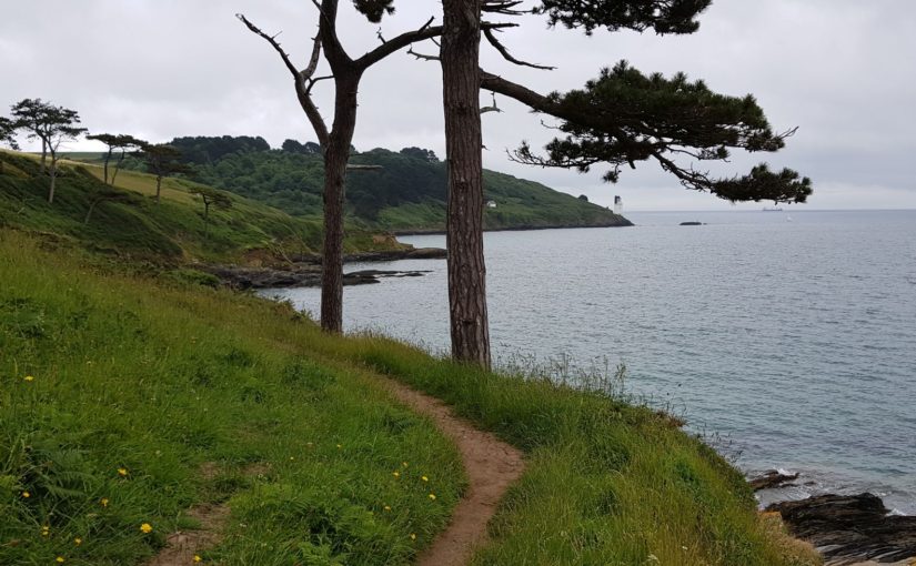
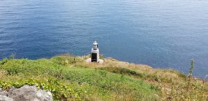 From Polperro I take Reubens Walk as an alternative to the Coast Path. That goes a bit closer to the coast and also comes closer to the mini lighthouse that is here.
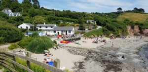
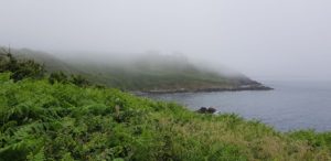
Then it goes to Talland Bay. We were here at the time. We then walked the Coast Path from Looe to Talland Bay and then went back inland. Unfortunately, everything was closed in Talland Bay last time. That is not the case now, there are quite some people. But hey, what do you want, it is Saturday, summer and good weather.
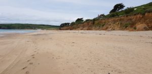
 From Talland Bay to Looe is a nice relaxed walk. It takes a while, but then Looe Island comes into view. Then I walk into Looe. Through the suburb and then on to the center.
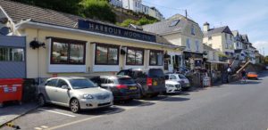 In the center I grab a pint at The Harbor Moon Inn. Here we also ended in 2009 after our walk. We also ate here. The kids wanted a hamburger, but there was only cheeseburger on the menu. So I ordered three cheeseburger without the cheese …
Weather
Another sunny day, nice walking weather.
Lyric of the day
Today it is again the 23rd, therefore a lyric for Ada. Although she is not a true Black Sabbath fan (understatement), I hope she can appreciate the great text. Here is Symptom Of The Universe:
Take me through the centuries to supersonic years
Electrifying enemy is drowning in his tears
All I have to give you is a love that never dies
The symptom of the universe is written in your eyes
Yeah
Mother Moon—she’s calling me back to her silver womb
Father of creation takes me from my stolen tomb
Seventh Advent unicorn is waiting in the skies
A symptom of the universe, a love that never dies
Yeah
Take my hand, my child of love, come step inside my tears
Swim the magic ocean I’ve been crying all these years
With our love we’ll ride away into eternal skies
A symptom of the universe, a love that never dies
Yeah
Woman, child of love’s creation, come and step inside my dreams
In your eyes I see no sadness, you are all that loving means
Take my hand and we’ll go riding through the sunshine from above
We’ll find happiness together in the summer skies of love


 Just after Charlestown there is a
 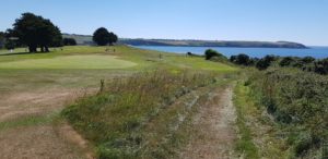 The route to Par is a breeze. Almost flat and for a large part along a golf course. Only the last piece is a bit less interesting. That part is also easy to walk, but not so beautiful. I have to walk around the clay industry.
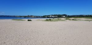 There is little to do on the beach in Par. That may be due to the industry that is just around the corner. In the village itself there are possibilities to have a drink, but I prefer to sit somewhere by the sea.
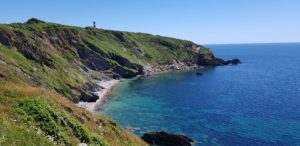 After Polkeris it goes up and down again a number of times, but in general it is also just a nice walk. When I arrive at Gribbin Head, it’s time for biscuits and drinks. We used to do that with the kids when they came from school. I sit on the bench at the day marker on Gribbin Head and enjoy the sun.
 I arrive at Polridmouth Cove and a little later things go wrong. So you walk on an as good as flat sand path in a small forest and a bit ahead a stile appears, a fence that you have to climb over. You look ahead at where you are going and do not pay attention to where you are walking. After all, that was the flat sand path… And then suddenly, spontaneously, a tree root jumps up the path, right in front of my feet! And what do you think? I stumble and go down completely, with my face straight on the path.
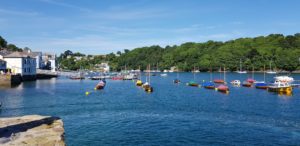


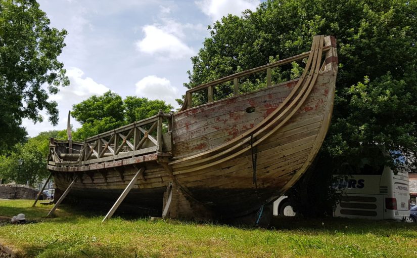
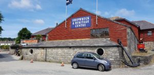 A short but heavy route today. It goes to Charlestown, a picturesque fishing village that is often used in film recordings such as Poldark and (for the elderly among us) The Onedin Line. Here are also some big old sailing ships. I have been here with Ada a long time ago and then with Ada and the kids in 2009. The weather wasn’t very good last time, so we went into the Shipwreck and Heritage Center.
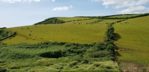
 After the meadows I arrive in Pentewan. This is a small village with a holiday park that is many times larger than the village. Here are the necessary opportunities for a drink, but it is still too early. I am just walking and have traveled less than 5 kilometers. So I go on.
 After Pentewan the ‘heavy’ part of the walk starts. It goes down and up steeply a number of times. As far as I’m concerned, it is not that bad, it’s heavy on the legs, but I got used to that. What I find more annoying is that quite a bit goes along some meadows that are very narrow. On the left there is barbed wire and on the right there are shrubs that partly grow on the path. The path itself is a narrow worn track. That means that you have to put your feet right before each other every time and that does not walk easily.
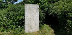 When I arrive at Black Head, I make a diversion to walk to the tip of Black Head. The Coast Path skips this, but since the route is already short today, I can manage a little extra.
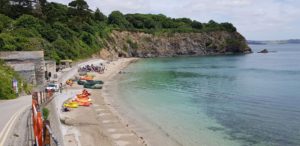 After Black Head it is not done with the steep slopes. It goes down and up again with stairs. Those steps are very uneven, as is normal on the Coast Path.
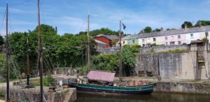 After the break it goes up one more time, via a regular staircase. Then I walk to Charlestown at ease. There I first sit on the terrace for a pint (or two) and then I walk around the harbor in Charlestown. I also walk past the museum that we visited with the kids in 2009.


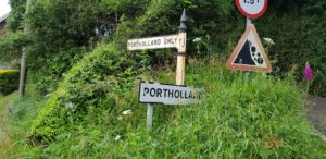 At one point I arrive in Portholland. That is so big that they have a west and east Portholland (but not really). There is also a kind of cafe, but that is still closed. No problem, it is still too early for coffee. I only have been on the path for about an hour.
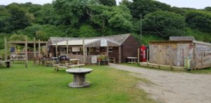 So on it goes and after half an hour I arrive at Porthluney Cove. Here is also a beach café and now it’s time for coffee. It is not really hot. Outside the cafe I see someone’s backpack and a …. didgeridoo. Sure enough, Jonnie Seaside is also in the café for coffee.
 When I arrive in Gorran Haven it is time for coffee at the Mermaid Café. When I sit outside to drink my coffee, it starts to drizzle.
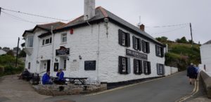 After another small piece of Coast Path I get back into the built-up area, first in Portmellon Cove and then in Mevagissey. I am once again too early at the B & B. This one is on the hill and the village (with the pubs) is down at the seaside. So down for a pint and then later up again for the shower.


 I start today with a walk around Pendennis and then through the center of Falmouth to the Prince of Wales Pier. That is still 4.5 kilometers before I am at the ferry.
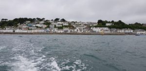
 After a while I meet Jonnie Seaside. I have met him on the Coast Path before, he has a didgeridoo with him. We chat a bit and he plays for me and explains what circular breading is, inhaling through the nose and, at the same time, exhaling through the mouth. You have to be able to do that to play continuously.
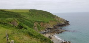 During the last few kilometers, it is a little harder with a few steep slopes around Nare Head, but nothing that really bothers me.
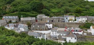 On some days you can already see the final destination from afar, sometimes even days before. Today is not such a day. Only if I have to walk less than half a kilometer, I can see Portloe. Another small stretch and then a pint at The Lugger (because the Ship Inn is closed).


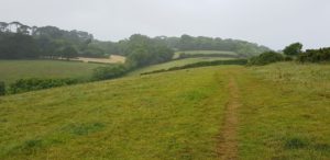 I walk through some meadows and I wonder why the cows always have to shit exactly on the ‘path’. You always see a kind of path running through a meadow. If you look at the number of cow pies over the entire meadow and you compare this with the number on the path, then I think that there are more cow pies on the path than is statistically justified.
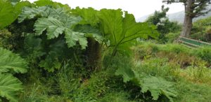 Then I see the plant with the large leaves again. This time there are more of them, but the leaves are not that big, but it is the same plant (I think). I still do not know what it is…
 At Maenporth beach I am almost halfway and I take a break. A cup of coffee under the roof of the beach cafe. It is not cold, just wet. When I take off my coat, I wonder which side is wetter, the outside or the inside.
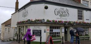
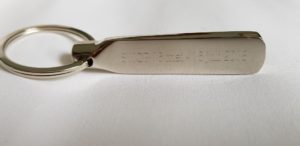 When I arrive at the hotel to check in, a package is waiting for me with the message ‘happy fathers day’. When in my room it appears to be a gift from the kids and Ada, a heavy engraved key ring with on one side “SWCP 16 mei – 16 juli 2018” and on the other side “Down by the seaside”. I am very happy that they have thought of me!
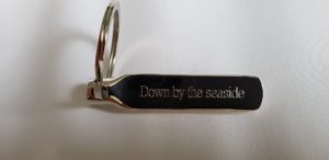 Well, I actually wanted to choose something from Saxon today because I started at Saxon Cove this morning. But that was before I received my Father’s Day gift from Ada and the kids. Given that gift today it is obviously Down By The Seaside by Led Zeppelin:


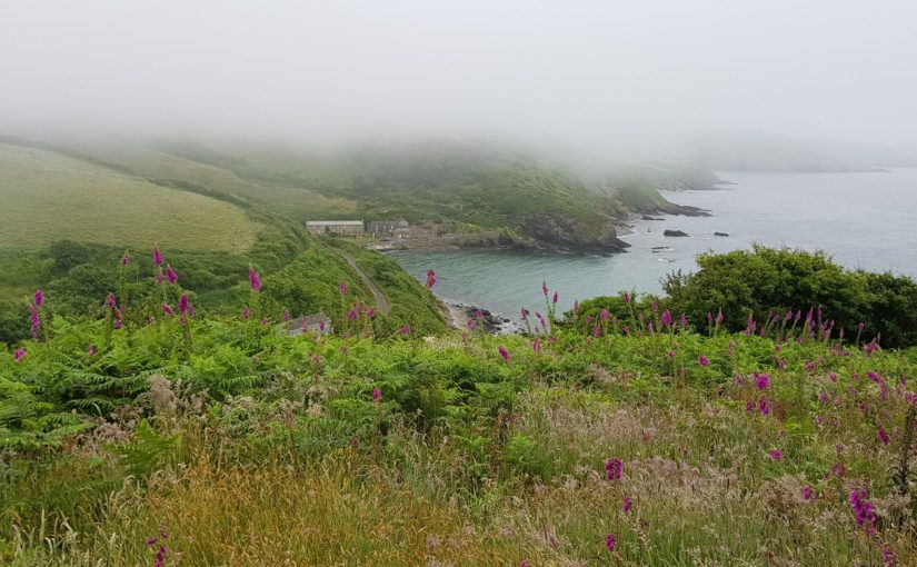
 Today it starts rather flat. I go first to Lowland Point and as the name suggests it is not really high here. Then the route would actually go through a mining area. However, this doesn’t happen because of a collapsed cliff with accompanying diversion. And what a diversion, it immediately goes up steeply and for quite some time. It was long ago that I had to climb like that (that was more during the first walks of the Coast Path). Then the diversion goes through the inland and it is not that bad.
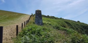
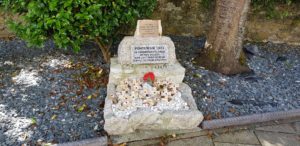
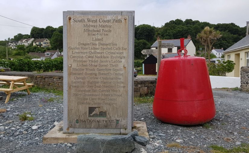
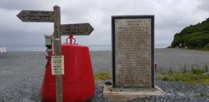 A few more kilometers and I’m at the Half Way Marker. That means I done half of my walking adventure. That calls for a celebration!
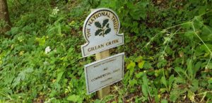 After having followed some low cliffs, I have to cross Gillan Creek. There seems to be a ferry and at low tide it is also possible to cross via stepping stones or even wade through the remaining water. That would shorten my route today with a few kilometers. Of course I am going for the other option, walking around it.
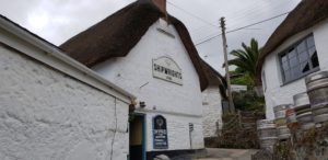 Now it goes towards Helford via an uneven forest path along the river. Here I have to cross the Helford River. Walking around it is not really an option (too long), so the ferry it will be. I actually planned to drink a pint on the other side. However, that will be slightly earlier. The ferry will only start again at 16:00 (because of too little water) and I am there around 14:30. That means waiting, but that is no problem. There is a pub close by, The Shipwrights Arms, and it is open. Time to celebrate that I’ve been halfway…
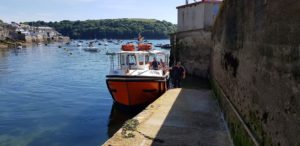
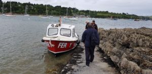 After a Guinness and a Proper Job it is 16:00 and I walk to the ferry again. I’m the first one there that wants to cross and I open the sign (a yellow round board) to indicate that I want to go to the other side. After a while the ferry arrives. The ferry is nothing more than a motorboat with a maximum capacity of 12 people. There are no more life jackets on board and the skipper is expendable …
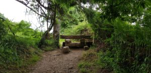 On the Helford Passage side I continue with the Coast Path. Actually, I am ready for today, but to get to Mawnan Smith, I better walk a bit further and then go to the village. So I do that, that makes the route of tomorrow a lot easier.


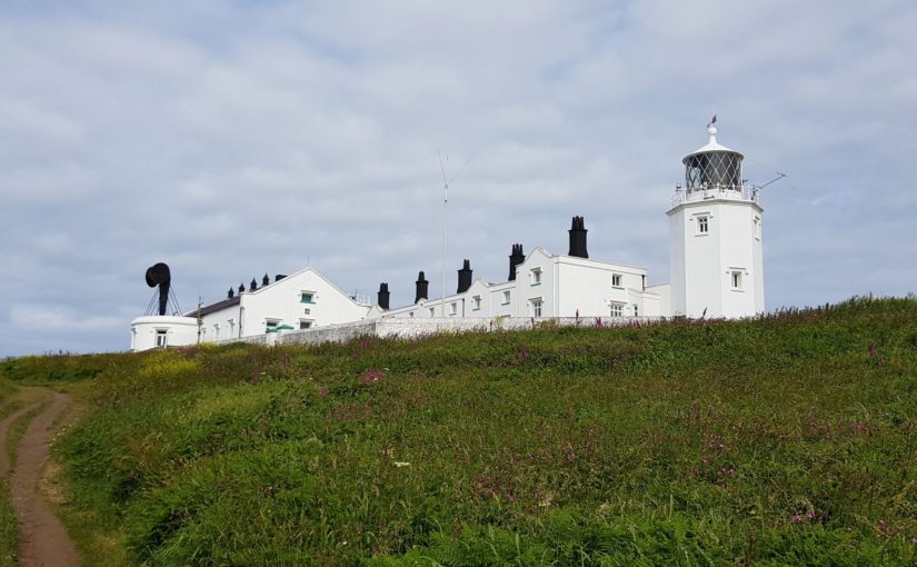
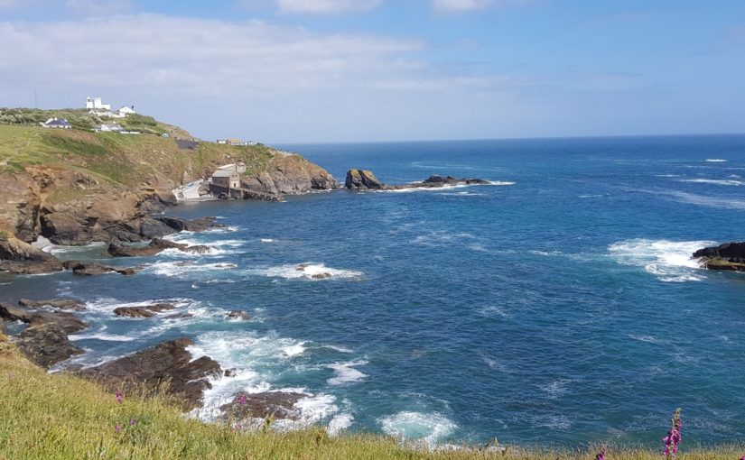
 First it goes back to the Coast Path, via The Lizard lighthouse. There are many Serpentine rocks (
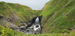 After a while following the Coast Path, I arrive at The Devils Frying Pan. This is a natural arch through which the water can pass to get into a kind of natural bowl. I can imagine that that gives spectacular effects when the sea is very rough. That is obviously not the case today (and maybe just as well).
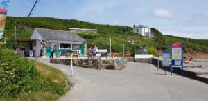 In Kennack Sands I take a break at The Beach Hut, time for coffee. From here there is nothing until Coverack. That is why my landlady thought I should have something with me, hence the packed lunch.
 When I’m at Black Head, it’s time for a break and for my packed lunch. A sandwich with cheese and marmalade (homemade bread), a scone with marmalade, a mandarin and a fruit bar. Everything neatly packed and with a napkin. A very tasty snack!
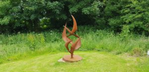 I am almost in Coverack, only a few kilometers. On the last part there is another diversion. That is not so bad, this one passes The Terence Coventry Sculpture Park. Here I look at some of the sculptures that are on display here. I have to miss Baarlo Steengoed, but here I have at least some sculptures.
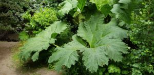 If I follow the detour further, I get a bit of a shock when I go around a corner. There is a plant with huge leaves. It is only one plant and there are only a few leaves, but they are worth it. Anyone any idea what kind of plant that is?
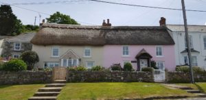 After walking a bit over narrow forest paths, I arrive in Coverack. Here I am immediately invited to an event that will take place soon. I get a flyer. If I look at this later, it turns out to be Jehovah’s Witnesses.
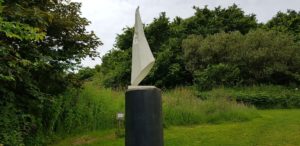 Today I looked a lot at stones (on the path, as well as in the rocks, and at the sculptures in The Terence Coventry Sculpture Park). That is why I chose The Sabbath Stones by Black Sabbath as the lyrics of the day. This also fits more or less with the encounter with the Jehovah’s Witnesses…


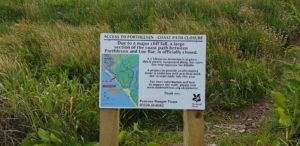 I am off to good start today, even before I am at Loe Bar, I have a detour. A piece of the cliff edge has collapsed and therefore I can not get through. There is no fixed new route yet, but a temporary one. A diversion of more than 4 kilometers for a stretch of about 100 meters.
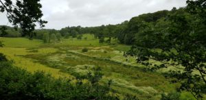 I do not regret it afterwards. The diversion goes inland and is a nice alternate route between meadows, with a piece of forest and the last part goes along Loe Pool. Nothing wrong with that.
 In Dollar Cove there is a small cafe, no more than a counter in the wall with a few chairs in front of it. But in the shade, so I take a break for a cup of coffee.
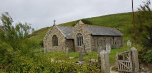 After Dollar Cove, Gunwalloe Church Cove follows. It is called that because they have built a church here, the church of the storms, with the associated cemetery. Not the most obvious place. They found out for themselves because a lot of maintenance is needed. The church suffers a lot from the sea (and the storms).
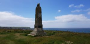
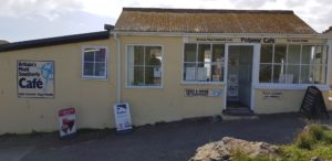 Lizard Point is the southernmost tip of England. Another milestone. I celebrate it with a pint of Fire Raven from the Cornish Chough Brewery in the southernmost cafe in England.
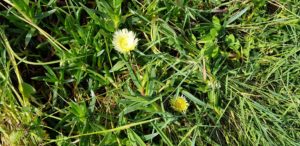
 Then it goes to the B & B of today, in The Lizard (the village). That’s another 2 kilometers.


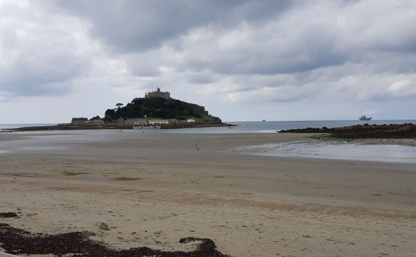
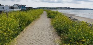 The first part of today goes via a bike / walking path to Marazion. Here is St Michaels Mount, a tidal island with a castle on it. A tidal island is only island when the tide is high, at low tide you can just walk to it. And that’s exactly what I do. I can almost walk into the harbor, from the sea side that is. But unfortunately, there is just a trench of water too much. So via the regular route, a road of boulders.
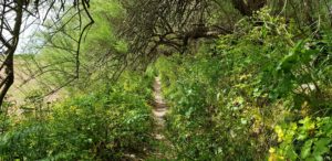 After Marazion follows a more regular part of the Coast Path, over narrow paths that are partly overgrown. Today, the vegetation is not too bad. However, the vegetation today is more hostile, nettles as high as I am and stitching stuff that can be felt through my jeans. I seriously wonder how those hikers do it that walk with bare arms and legs when walking these kind of paths. That has to be a painful affair. There were parts today where you can not escape the nettles below the waist…
 After the break it goes on to Praa Sands. Here I walk a stretch over the beach. As I approach the end of the beach, I wonder if I can go up somewhere. The cliffs rise from the beach and I do not see an access anywhere. I do see a limited number of people on the beach at the back, which gives hope. And indeed, hidden behind a rock, I find a narrow stone staircase leading to a small bridge where I get back to the Coast Path.
 Until now it was not all that exciting. After Praa Sands that changes somewhat, it goes up and down more and the path is sometimes very uneven. There follows a large part that goes over the cliffs. Those cliffs are not very high here.
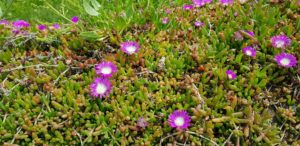 There are Hottentot figs (


