
Date: 20180705
Time: 9:15 – 15:40
Distance: 24.7 km (+ 2.9 km ferry)
Stay: Dolphin Hotel, Exmouth
Walk
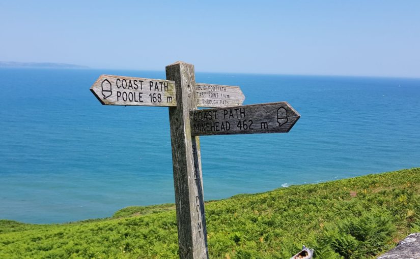
 Today I have a long and varied day ahead. The first piece is pretty heavy, after that it is not too bad. I also have two ferries, one on the Teign and one on the Exe. Especially the latter, at the end of the walk, I have to get. Officially the last one is always at 16:10 and in the season (now) at 17:10. But apparently the last one is sometimes skipped when there are no passengers. Well, today that will probably not be a problem, but I’m definitely aiming for the 15:10 one.
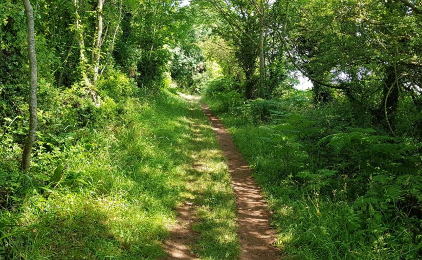
 But first the tricky part. From Babbacombe to Teignmouth it goes over the cliffs and it’s constantly going up and down. Normally when you walk up, you stay there for a while before you go down again. But not today. When I am up, it immediately goes down again and when I am down, I immediately go up again. That’s what they call wearing out…
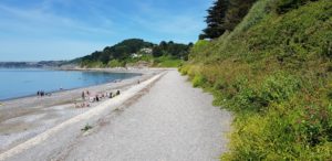
 When I arrive in Shaldon, that is fortunately over. There I take the first ferry to Teignmouth. The ferry arrives just as I arrive at the beach.
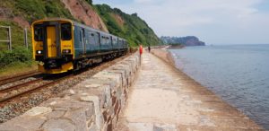 Then the route is characterized by long flat sections and occasionally a hill. Those long flat sections consist largely of two sea walls that I walk over, 1 in Teignmouth and 1 in Dawlish. That is possible because it is low tide. Both sea walls run between the railway and the sea. Once you start, you can only finish them or go back.
I especially like the first sea wall in Teignmouth. Which I think is never under water, but after a few kilometers you have to go under the railway and that part is flooded at high tide. So if you do not pay attention in advance, you can walk back a few kilometers …
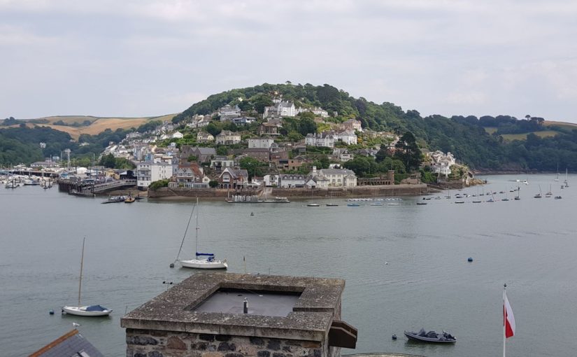
 When I arrive at the river Exe, I think I am close to the ferry. However, that is disappointing, for that I still have to walk 4 kilometers. The stretch is completely flat. It goes along the Exe Estuary Trail, until I am in Starcross. The ferry leaves there. When I arrive, I just see the ferry of 14:10 departing. No problem, close by there is The Atmospheric Railway Inn and I go inside for a pint.
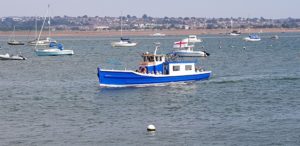
I’ll am ready for the ferry at 3 o’clock. There is no one else. A little later two ladies arrive who also want to go with the ferry. It arrives a little later and after all passengers have been unloaded, we can board. The crossing from Exmouth to Starcross seems a lot more popular than the other way around. 20 people came off the ferry and we are still only three.
On the ferry we get the safety notice that there are 56 lifejackets on board. Well, that is reassuring if it comes to that.
In Exmouth I only have to go a short distance to the hotel. Time for a shower.
10 more walks to go…
Weather
Fortunately, it was good weather today. Sunny, warm and dry with a light breeze.
Lyric of the day
I have now passed the 500 miles (officially, in reality I walk more). Hence today the lyrics I’m Gonna Be (500 miles) from The Proclaimers, a very appropriate text:
When I wake up, well, I know I’m gonna be
I’m gonna be the man who wakes up next to you
When I go out, yeah, I know I’m gonna be
I’m gonna be the man who goes along with you
If I get drunk, well, I know I’m gonna be
I’m gonna be the man who gets drunk next to you
And if I haver, hey, I know I’m gonna be
I’m gonna be the man who’s havering to you
But I would walk five hundred miles
And I would walk five hundred more
Just to be the man who walked a thousand miles
To fall down at your door
When I’m working, yes, I know I’m gonna be
I’m gonna be the man who’s working hard for you
And when the money comes in for the work I do
I’ll pass almost every penny on to you
When I come home (When I come home), oh, I know I’m gonna be
I’m gonna be the man who comes back home to you
And if I grow old, well, I know I’m gonna be
I’m gonna be the man who’s growing old with you
But I would walk five hundred miles
And I would walk five hundred more
Just to be the man who walked a thousand miles
To fall down at your door
Da lat da (Da lat da), da lat da (Da lat da)
Da-da-da dun-diddle un-diddle un-diddle uh da-da
Da lat da (Da lat da), da lat da (Da lat da)
Da-da-da dun-diddle un-diddle un-diddle uh da-da
When I’m lonely, well, I know I’m gonna be
I’m gonna be the man who’s lonely without you
And when I’m dreaming, well, I know I’m gonna dream
I’m gonna dream about the time when I’m with you
When I go out (When I go out), well, I know I’m gonna be
I’m gonna be the man who goes along with you
And when I come home (When I come home), yes, I know I’m gonna be
I’m gonna be the man who comes back home with you
I’m gonna be the man who’s coming home with you
But I would walk five hundred miles
And I would walk five hundred more
Just to be the man who walked a thousand miles
To fall down at your door
Da lat da (Da lat da), da lat da (Da lat da)
Da-da-da dun-diddle un-diddle un-diddle uh da-da
Da lat da (Da lat da), da lat da (Da lat da)
Da-da-da dun-diddle un-diddle un-diddle uh da-da
Da lat da (Da lat da), da lat da (Da lat da)
Da-da-da dun-diddle un-diddle un-diddle uh da-da
Da lat da (Da lat da), da lat da (Da lat da)
Da-da-da dun-diddle un-diddle un-diddle uh da-da
And I would walk five hundred miles
And I would walk five hundred more
Just to be the man who walked a thousand miles
To fall down at your door


")


")


 Na een tijdje kom ik bij Brixham Battery uit, alweer een verdedigingswerk uit de tweede wereldoorlog. Hier hebben ze er ook een militair museum bij gemaakt. Dat is in principe een groot woord voor het kleine gebouw en de paar oorlogs artefacten die ze buiten hebben staan.
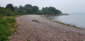 Even verder kom ik bij Elberry Cove. Hier loop ik over de pebbles en daarna verdwijn ik in het bos. Het gaat nu een flink stuk door het bos. In principe een lekker stukje lopen. Maar wel goed het pad in de gaten houden. Want behalve de normale stenen en rotsen, moet ik nu ook uitkijken voor boomwortels. Gevaarlijke dingen die boomwortels, als je niet uitkijkt springen ze zo voor je voeten…
 Nadat ik langs diverse stranden ben gelopen, kom ik in Paignton. Hier is helaas alles dicht, ook de Inn on the Quay. Begrijpelijk met dit weer, maar niet wenselijk. Gelukkig is er koffie te krijgen in de beach shop. Hier kan ik niet zitten, maar wel even schuilen. Het is namelijk weer begonnen met regenen.
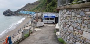 Na Torquay gaat het weer meer de natuur in. Bij het beach cafe op Meadfoot Beach is het weer tijd voor een kop koffie. Hier kan ik wel zitten, buiten wel te verstaan, maar dat is nu geen probleem, het is droog.
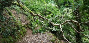 Na Meadfoot Beach gaat het naar Hope’s Nose en vanaf daar volgt weer een flinke boswandeling. Dit is wel relaxt wandelen, totdat ik bij een boom uitkom die nog maar pas over het pad gevallen is. Ik bekijk de opties en besluit om onderlangs te gaan. Je kunt zien dat dit nog maar pas gebeurd is. Afgezien van het feit dat de boom anders al opgeruimd zou zijn, is er nog geen echt alternatief pad ontstaan.
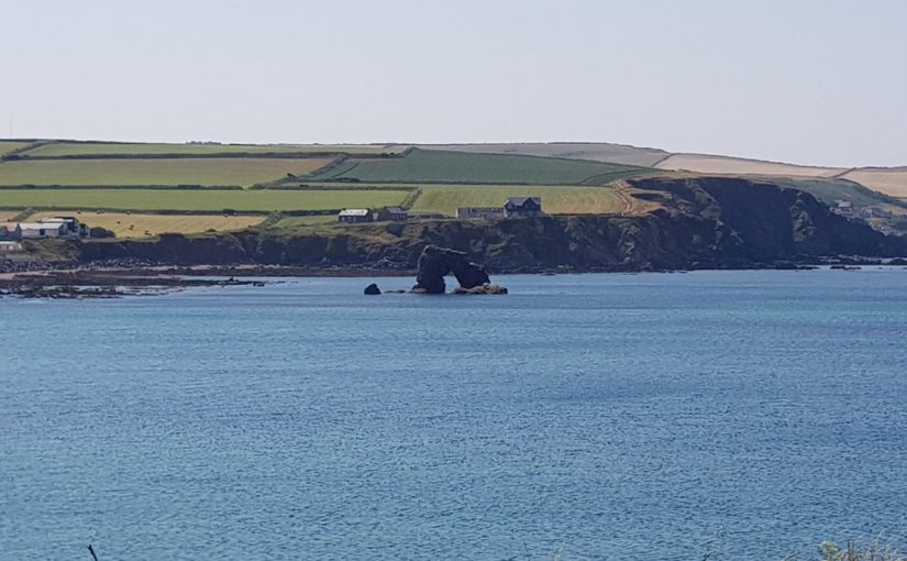
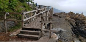 Als ik uit het bos kom, ben ik op Babbacombe Beach. Hier is het tijd voor een blikje drinken bij het strandtentje. Van Babbacombe Beach ga ik via een trappenstellage en een stukje bospad naar Oddicombe Beach. Hier gaat een klif baan omhoog. Ik volg deze een stukje omhoog, totdat het Coast Path afdraaid.
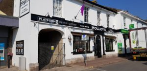
 Uiteindelijk ga ik weer helemaal omhoog de klif op. Daar verlaat ik het Coast Path om naar mijn B&B in Babbacombe te lopen. Als ik Babbacombe in loop, zie ik groot ‘Platform 5 Brewing Company’ op een gebouw staan. Een pub waar ze bier van een onbekende brouwerij hebben, tja daar kan ik niet aan voorbij gaan.
 Weer een grijze dag. Nog voordat ik Brixham uit was, begon het al te regenen. Dat ging later over in miezer regen. De rest van de dag bleef het erg grijs en af en toe viel er regen of motregende met. Weinig wind vandaag.


")


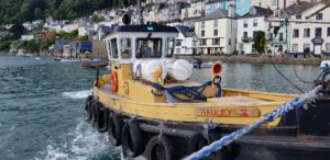 The day begins, as often happens on this side of England, with a ferry crossing, over the Dart this time. There are several possibilities, but I opt for the lower ferry and not the passenger ferry. The only difference is the starting point, they arrive at the same point on the Kingswear side.
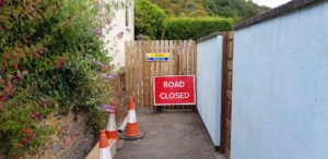 When I arrived in Kingswear I pick up the Coast Path again and I walk past a number of (holiday) houses. Somewhere I probably missed a sign because a moment later I can not continue. The path has been closed. So a bit back and then try again on the road a little higher up. There are Coast Path markings on that road. The old path has been closed due to an unstable cliff.
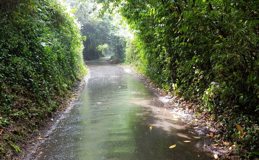
 When I’m out of Kingswear, it starts to rain. I walk under the trees and stay there for shelter. It is pouring, but fortunately the trees catch everything and I stay dry.
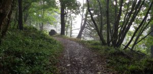 I think I got off well, but I’m wrong. A little later it starts to rain again. I still (or again) walk under the trees, but this time they do not stop everything (but a lot). Eventually I still get wet, although my pants remain largely dry. And all that without a coat …
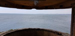
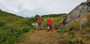 The path is being worked on. Three men are busy making the first step for a ‘staircase’. I have a chat with them and tell them that I am walking the entire Coast Path. Then they want to know if this part is the most beautiful part 🙂 To which I answer tactically that all parts are beautiful, but all different.
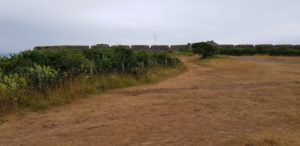 From Sharkham Point the height differences get easier and it continues a bit more on the same level, with gradual (and small) height differences. A little further at Berry Head it starts to rain again, fortunately just for a moment. On Berry Head you can see the remains of a large fortress from the time of Napoleon. Normally I would have made time for that, but given the weather I continue.


 It is raining pipe stalks (cats and dogs) during breakfast. According to the weather forecast, it would be dry around 11 o’clock (or at least dryer). I do not have that much patience, however, and I start walking as soon as it is dry.
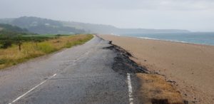
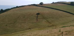 After Strete I walk through several meadows for a while. One of those meadows goes down very steeply and then almost as steep up again. Fortunately, in the course of time a kind of footstep emerged. Otherwise I would have had a challenge with the current weather on the wet slippery grass.
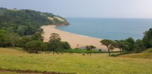 In one of the last meadows I suddenly look out over Blackpool Sands. Here I walk to and in the beach cafe it is time for coffee. When I take off my coat, I’m just as wet.
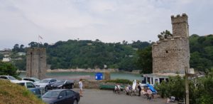 While a faint sunshine appears, I walk over tarmac roads to Little Dartmouth. From there it goes more along the coast. At a certain point, that changes into a forest walk to the Dartmouth castle. I walk past it and it is only a short distance to Dartmouth. The sun is shining now.
 I arrive in Dartmouth well in time and in the meantime I have dried up almost completely. The B&B is quickly found, but it is still too early. Therefore, first a few pints in the pub next to it.


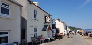 I pass Hallsands and Lannacombe, but there is nothing to drink anywhere. Only in Beesand I come to the Cricket Inn, finally something to drink (I have enough water with me, but something else and cold is also appreciated).
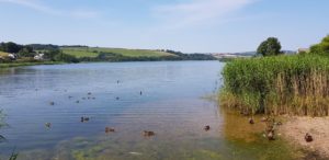 After that I have a few kilometers to go before I am in Slapton. The last part goes along Lower Ley and Slapton Ley. A rather boring stretch between a road along the beach and the largest natural lake in the south west. The path is very poorly walkable due to large sections with loose sand (I would have been better off walking on the beach).
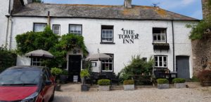 Eventually I arrive at the Tower Inn in Slapton. It turns out to be closed … But luckily someone shows up so that I can go to my room. Shoes off, slippers on, backpack off and then back a few hundred meters. There was the Queens Arms and that was open 🙂
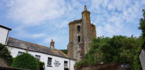 Today I stay at The Tower Inn, which takes its name from the remaining western tower of The Collegiate Chantry or St Mary (a group of priests who sang for someone’s salvation, in this case apparently in a nice building). So I took a lyric from the old days,


")


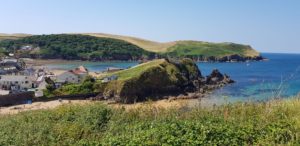 Today also starts very relaxed. I walk to Hope Cove, there are the villages Outer Hope and Inner Hope. Here are opportunities to have a drink, but it is still too early.
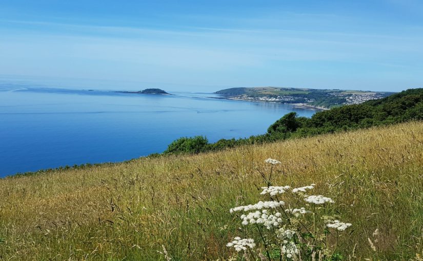
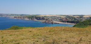 After Hope Cove it is done with relaxing. It goes up to Bolt Tail, but not too steep. From Bolt Tail you have a very nice view, mainly on the part that I have walked the last few days.
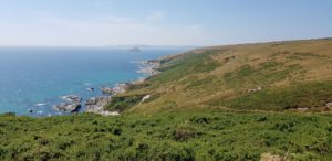
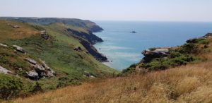 Once I am at the top, it continues with a relaxed part with relatively few height differences. But then it suddenly goes all the way down and pretty steep. And as it goes on the Coast Path, almost immediately straight up towards Bolt Head. During this climb I have to cover a narrow path right along the cliff edge. Fortunately, there is almost no wind on this stretch. That could have been quite annoying. The last part rises steeply against a grass slope, the wind is back at full strength and I walk against the wind. That is a hard part.
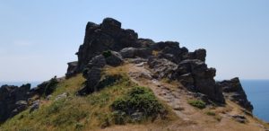 Then it goes on to Bolt Head in a relaxed manner. That is at about the same level and then just before it goes down again.
 After Bolt Head it goes to Salcombe. A few kilometers through civilization and then a pint at the Ferry Inn.


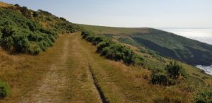 The start of today is easy, a long and wide grass path above the cliffs. Since the farm I stayed in last night was also on a high location, I do not even have to walk up. The view is once again great, in all directions.
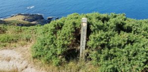 After a few kilometers of relaxed walking, I take an alternative from the Coast Path so that I pass the Church of St Peter the Poor Fisherman. As always, there is a price for this detour. It immediately goes down steeply and later I will have to go up again, the Coast Path continues relaxed at the same level.
 The
The 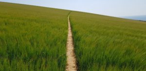 The wide grass path where I am now walking again, changes slowly and becomes narrower. There are also more gates that I have to go through and at some point it goes through meadows and fields again. One of those fields is very nice, a whole field full of wheat (knee high) with a narrow path through it. That looks nice.
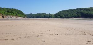 Well, and then I was standing in front of the Erm, a river that I had to cross. In principle you can wade this river one hour before and one hour after low tide. That was exactly at 1 o’clock today and I was there a little after 12 o’clock. Nice on time.
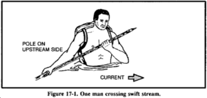 On the spot, I decided to take the guess and risk my life and wade through it. Where other hikers had failed, I would prevail. So I stripped down to my underpants, stuffed everything in the backpack and went barefoot into the water. I immediately felt the current and I was able to keep up with a lot of effort. Step by step it crossed the wild flowing river to the other side. The water stood up to my chest and I was able to keep my things dry over my head with great effort. Under my feet I felt razor-sharp stones that destroyed my soles. What did I get myself into…
 After the Erm it went to the next river, the Avon. The route became a lot heavier on this part, between the two rivers. It went up and down again and occasionally very steep. However, this was rewarded with even more amazing views than I had this morning. A lot of up and down usually also means a much rougher coast and that gives beautiful views.
 The result of all that climbing is that I start to get very hot. Luckily I arrive at Bigbury on Sea at one point and on the first occasion I stop for a pint of Guinness. That’s at The Waterfront, here they have Guinness Extra Cold, that’s good. I can use that now.
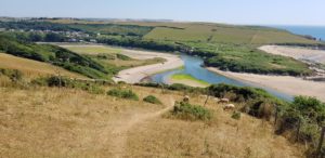
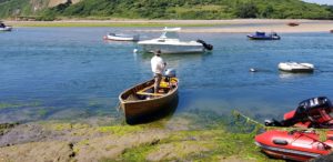 I know approximately
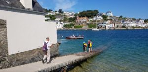
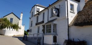 While we are having a chat, the ferryman takes me to the other side. I only have to walk a little bit up to the village to find the Sloop Inn.


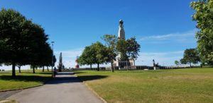 After breakfast I first go to the Tesco around the corner to replenish my water supply. Then it goes through Hoe Park and past the Smeaton’s Tower towards the Barbican.
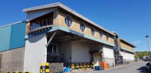 Then it goes all around all the water that they have in Plymouth to Mount Batten. That looks like a short walk, but is almost 10 kilometers. I could have done this with a ferry, it is not the most fun part of the Coast Path. But I do not want that. It is part of the Coast Path and so I walk it.
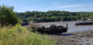 It is in any case something completely different, first through the entertainment district (because of a detour, the footbridge is closed because it is damaged), then through industrial sites (old and new, fishing / boats related and all kinds of other companies), the suburbs from Plymouth and finally a marina. On the way I come across several half or almost completely rotten boats.
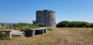 Eventually I arrive at Mount Batten, a few hundred meters from where I walked this morning (on the other side of the water). I also visit Mount Batten Tower, but unfortunately it is not open.
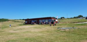 Now I come back on a part of the Coast Path that I am used to, through nature and close to the sea. At the Jennycliff Café I take a short break for a smoothie and after I have passed the Bovisand holiday park, I leave behind the last remnants of civilization, until to Wembury Beach.
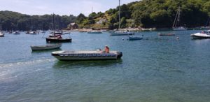
 The first piece goes up through a forest. That is nice with this warm weather, shade. Then it goes over a wide walking path further along the top of the cliff. That part is a bit heavy, in the full sun and after I have already walked that far. I keep going and finally I come to the place where I leave the Coast Path and head towards farm. I arrive there just before 4 o’clock, time for a shower.
 After I have showered, I walk for half an hour to the pub for a pint and something to eat. It goes downhill, so that is not so bad. I will not be walking that part up again, I will call Jackie (the owner of the B & B) to come and get me.


 The owner of the hotel tells me a shortcut. There is a shorter way from the hotel to the Coast Path than back where I came from. But then I miss a part of the path. In addition, I still want to walk through Crafthole to replenish my water supply at the local store.
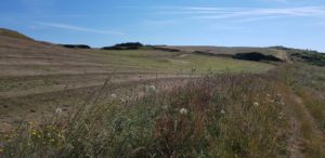 The first part goes along a golf course, there are already a few people playing golf on the Monday morning. I have a chat with one of them. He does not understand that we are not participating in the World Cup. I do not know what he is talking about 🙂
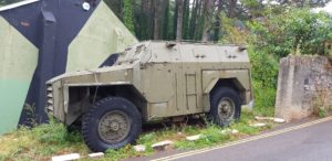
 Then it becomes exciting, I go through the firing range, a military training ground. There are no red flags, so it will be fine, I hope. This is much better than the alternative, two kilometers along a fairly busy road without footpath along it. I walk past the shooting ranges and then arrive at Tregantle Fort. This is one of the many forts built around 1860 to defend naval bases against a French attack (that never came).
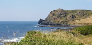
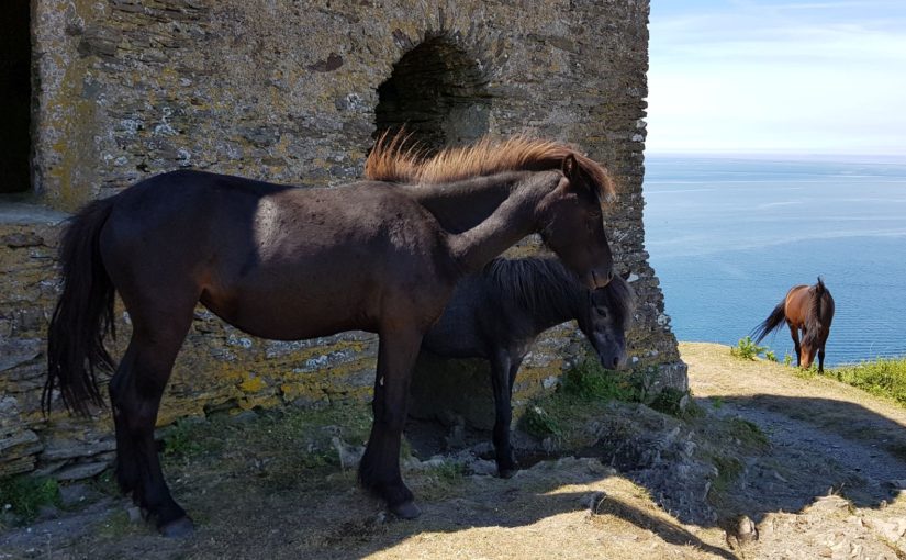
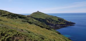 Then it goes towards Rame Head, a headland that I already can see for a while. Once there I make the effort to walk to the top, to the chapel of St Michael the Archangel on Rame Head. The chapel has been there for about 600 years, although the current version was renovated in 1882.
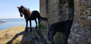 At the top I see that there are ponies walking around. In fact, the ponies have take over the chapel as a shelter. So the chapel has become a sort of pony stable…
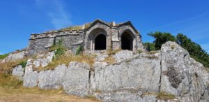 I continue to Penlee Point. Again a chapel or grotto can be admired here. For this I have to go down a bit. It is the chapel / grotto of Queen Adelaide. Originally an 18th century lookout, the chapel / grotto was created and named after Adelaide, a German princess and wife of the Duke of Clarence, who visited it.
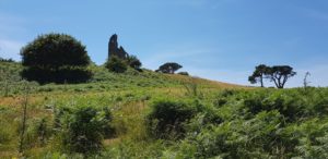 After Penlee Point, a longer forest walk follows to Plymouth, via Cawsand and Kingsand. I come across a real fake ruin, built as a replacement for a navigation obelisk. In the end I walk through old gardens with their own Orangery.
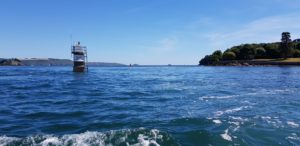 Then it’s time for a ferry again. When I arrive, the ferry is already there. So quickly on board. When arriving at the other side, I am not quite where I expected to be. According to my data, the ferry should have taken me a bit further. No worries, I just walk there and then continue the route. So I do just that. Only to come to the conclusion that I can walk back the same stretch again because that is the route…
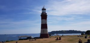


")


 Before I leave, I first make a round through Looe.
 The route now passes
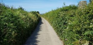
 After the coffee I walk the alternative route over the Seaton Sea Wall Walkway and then over the beach. Beach is a big word in this, there is some gray sand, but mainly pebbles and rocks.
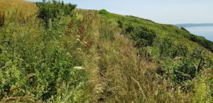 Until Portwrinkle I walk on the usual Coast Path paths. Sometimes narrow and sometimes somewhat wider, sometimes well passable and sometimes overgrown, sometimes right along the cliff edge and sometimes a good deal from the edge, sometimes free and sometimes with barbed wire along it.
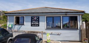 In Portwrinkle I walk along the ‘boulevard’ to the Jolly Roger, the beach café. I have reached my final destination, but not my hotel yet. Still, I think it’s time for a pint.
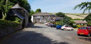 After enjoying my beer, it continues. My hotel is a bit further on, in Crafthole. That turns out to be about a mile away. But the hotel is nicely secluded, between the hills.
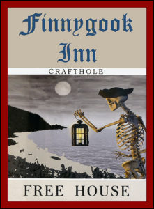 Portwrinkle and Crafthole have their own real ghost,


