
Date: 20180601
Time: 9:35 – 15:35
Distance: 23.3 km
Stay: Penlan B & B, Porthcothan Bay
Walk
I continue where I left off, Today it goes from Padstow to Porthcothan, a stretch of a little more than 20 kilometers. It will be an easy route because there are not many height differences and where there are, they are not very big and certainly not steep.
 From Padstow it immediately goes up and after that along narrow paths with lots of vegetation. This ensures that after a while I am wet again, even though it does not rain. But that is no problem, it will dry up over time. However, I am also covered with pollen, but that too is not a problem since they can be brushed off easily.
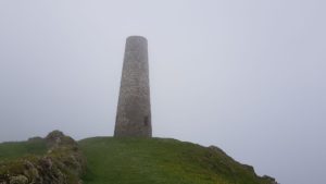
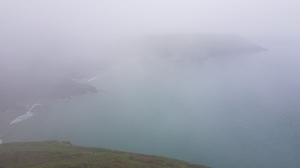
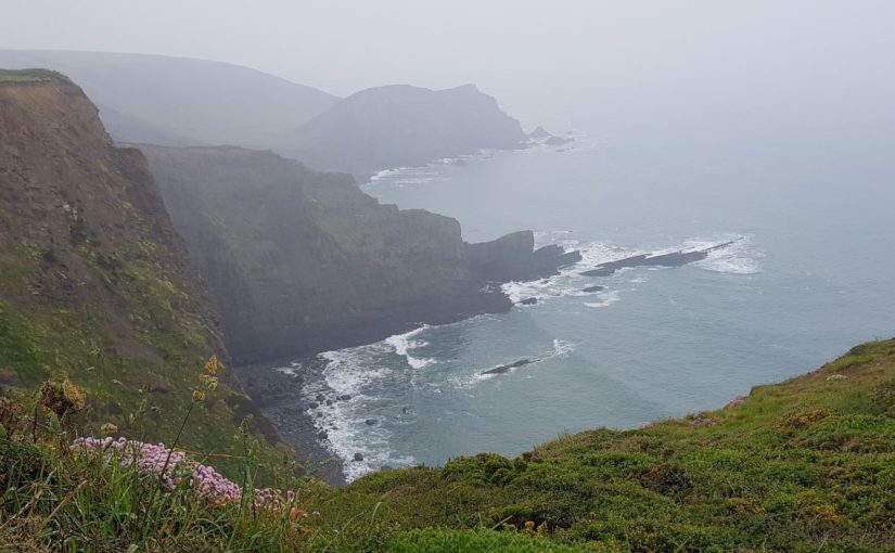
After a while I pass the tower at Stepper Point. This is a navigation aid (Daymark) that was built in 1820. Unfortunately, there is little view, it is foggy.
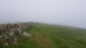
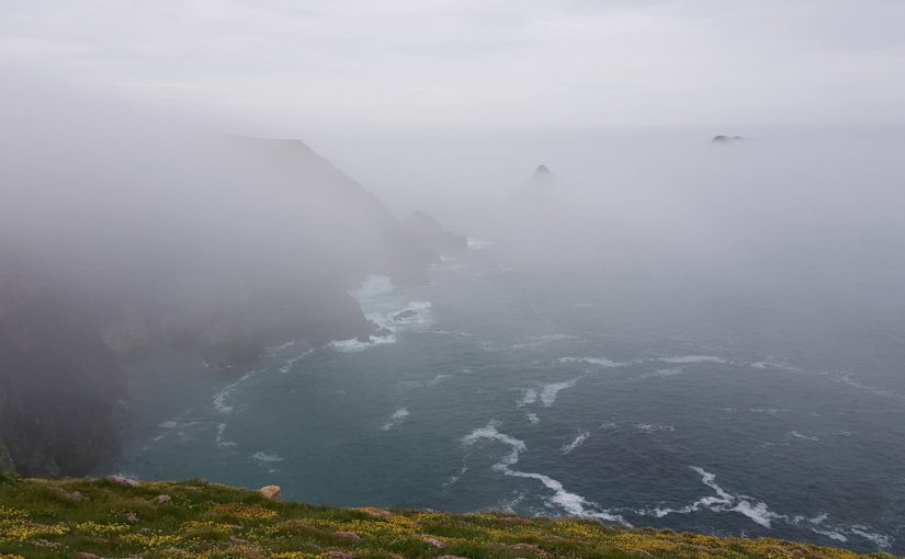
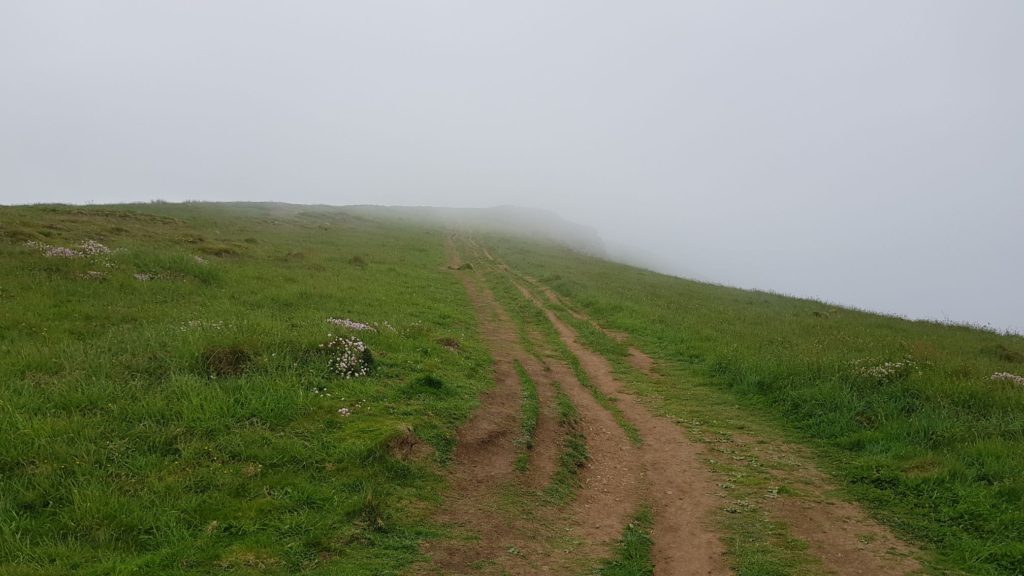
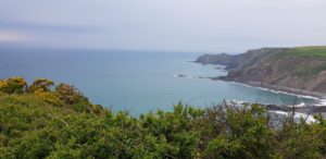
The fog gives the next part that I walk a very special character. I can look over the edge of the cliff, but I do not see the sea. At times, I do not even see the cliff edge. Looking ahead is also limited. However, the Coast Path is easy to follow and occasionally I encounter markings.
I see the mist rolling in from the sea.
After a while the fog starts to rise. Or actually I walk out of it because when I look back, I see more low clouds than where I am.
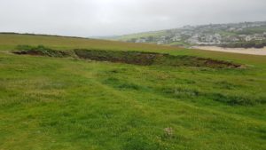
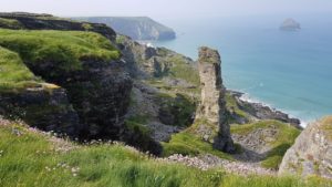
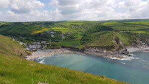
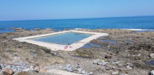
As I said, today I have an easy route and it goes quite flat over the cliffs to Trevone Bay. Just before Trevone Bay I pass Roundhole Point. This is named like this because there is a huge round hole in the ground (cliff) (in Cornwall they like to call things as they are 🙂 ). Roundhole was formed because erosion created a cave that collapsed over time. It is about 80 feet deep and at high tide, there is water at the bottom.
In Trevone Bay it is time for coffee at a beach café.
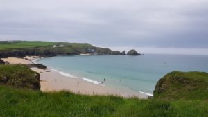
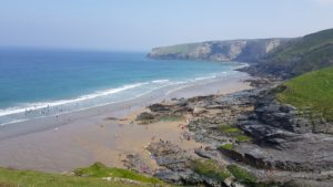
After the break, I continue towards some large beaches. First comes Harlyn Bay, then Mother Ivey’s Bay, Booby’s Bay, Constantine Bay and finally Treyarnon Bay. At most baysI walk above the beach, but in Constantine Bay I walk quite a bit over the beach.
At the last beach, in Treyarnon Bay, it is time for a pint at the local youth hostel, I am now about 10 kilometers further and not too far from my final destination.
If I want to continue, Davey shows up. He has caught up with me during my rest day. He stays in the youth hostel tonight and is therefore at his final destination. I have a few more kilometers to go.
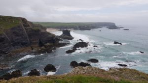
During the last part it starts to get foggy again. I pass a few nice rock formations and then Porthcothan suddenly turns up behind a bend.
Today I also saw a number of remnants of installations from the Second World War, but there was not much to see, these were mainly concrete plains.
Weather
The temperature was fine today. However, it was very cloudy and misty from time to time. I walked with my head in the clouds again, not because I was so high, but because the clouds were so low. Due to the fairly high temperature and humidity it was a little muggy.
Lyric of the day
Since I often could not see the sea, the lyrics of today are obvious, Smoke on the Water by Deep Purple. Mist does look like smoke…
We all came out to Montreux
On the Lake Geneva shoreline
To make records with a mobile
We didn’t have much time
Frank Zappa and the Mothers
Were at the best place around
But some stupid with a flare gun
Burned the place to the ground
Smoke on the water, a fire in the sky
Smoke on the water
They burned down the gambling house
It died with an awful sound
Funky Claude was running in and out
Pulling kids out the ground
When it all was over
We had to find another place
But Swiss time was running out
It seemed that we would lose the race
Smoke on the water, a fire in the sky
Smoke on the water
We ended up at the Grand Hotel
It was empty, cold and bare
But with the Rolling truck Stones thing just outside
Making our music there
With a few red lights and a few old beds
We made a place to sweat
No matter what we get out of this
I know, I know we’ll never forget
Smoke on the water, a fire in the sky
Smoke on the water


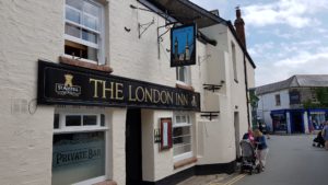 After first walking a little through Padstow (this doesn’t take too long, but on request some pictures of pubs), I look at the offers of the various boat trips. I decide to go on a boat trip with the Jubilee Queen. An hour and a half, not too expensive and one doesn’t get wet (I did that already yesterday).
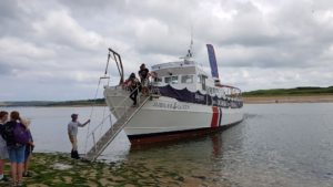 I get on board at the quay in the village. Fortunately the boat is not packed full. The GPS track below is from the boat trip and not from a walk (I still can not walk on water).
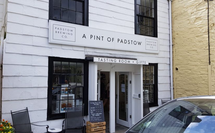
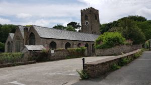 There is a brewery in Padstow, the Padstow Brewing Company. I have to visit them. Google comes to help with an address and the route. First I have a Cornish Pasty and then I walk to the brewery. Along the way I pass the church and the cemetery. After that I have to go a long way along a fairly busy road, without a footpath. Not the best of walking routes.


 I start on time because at the end I have to catch the ferry from Rock to Padstow and I want to be there in time (otherwise it will cost me a taxi).
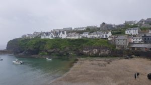
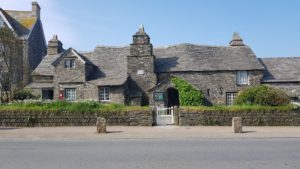
 Before I start my walk, I first walk through Port Isaac. The town is famous because it the
 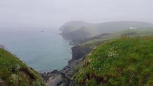 Although the sting is in the beginning, it is not that bad. The hills are not that high anymore, so every climb and descent is a lot shorter. There are a number of steep slopes to take, but I can manage that. However, I have to be careful because everything is wet. Especially on rocky stretches that means it is slippery.
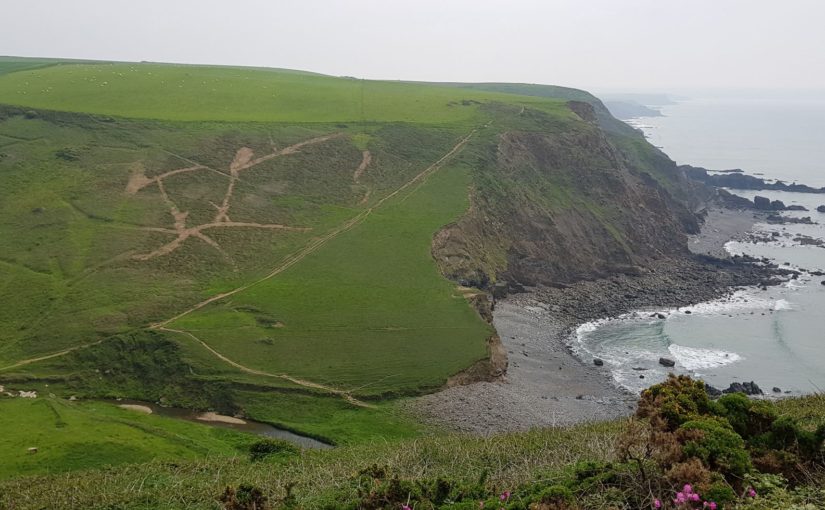
 After about 5 kilometer I reach Port Quin, a hamlet by the sea. Normally here in the parking lot one can get something to drink (from an old Citroen HZ), but today they are closed because of the beautiful weather. Too bad, I really would have liked a cup of coffee.
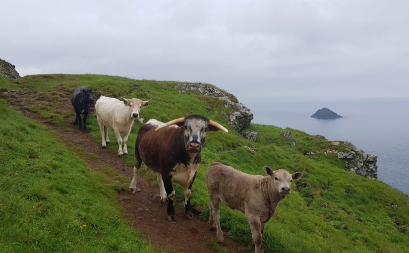
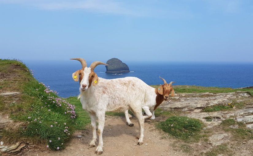
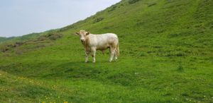
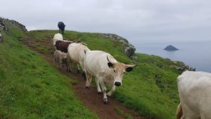 And then you walk on a not too wide path, along a cliff, and then there are about 10 cows that want to pass you. Going back does not make sense, then you get stuck on a stile. So, crawl against the edge as much as possible and stay as still as possible. The cows have a look at this, they do not trust it completely. Then they pass by one by one. One of the last is a calf and that needs more time before it dares to pass. But in the end it takes a sprint and shoots past. The cow behind it looks at me for a moment as if to say: how dare you against a calf …
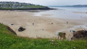


 Before I started the official walk today, I first went into Tintagel. The old post office is mentioned everywhere and the church. There are also the King Arthur’s Great Halls. Everything in Tintagel has a connection with King Arthur (even if only in the name). You would almost imagine yourself in the Middle Ages, were it not that it is all very touristy.
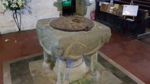 Then on to the church, which lies on top of the cliffs, a little away from the village. Of course with associated cemetery. There is a special old font in the church. After having taken the necessary pictures, I lit a candle so that the rest of my trip will also go smoothly…
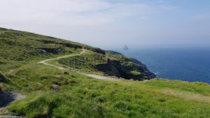
 Obviously steep as I have come to expect from the Coast Path. This was immediately after Trebarwith Strand, the last civilization before the end point of today. Unfortunately, this was a bit too early for a break, I had just started walking.
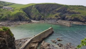 After all the ups and downs I finally arrived in Port Gaverne, a hamlet just next to Port Isaac. However, the height differences were not done yet. I had one last climb to get to Port Isaac and one descent.
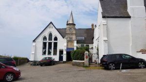 In the end I was very early done today. Partly because I left on time, but also because the route today was not very long. Time for a pint at the Golden Lion.
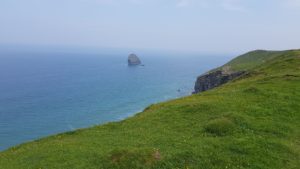 Rain was predicted later in the day. Indeed, official weather warnings were in force regarding thunderstorms and flooding. But these are normally very local and the chance that you are affected is not that big.
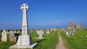 Since I spend the night in Tintagel and everything is dominated by the Middle Ages, today a song by a group that makes medieval music (both acoustic and a combination of rock with traditional instruments). Today Spielmannsfluch by In Extremo:


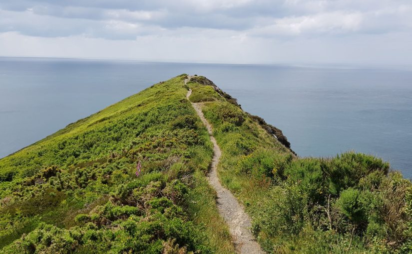
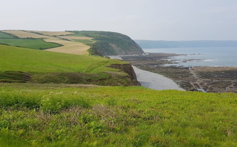
 Before I get there, however, I first have to cross the highest cliff in Cornwall. The ascent is alternately easy (read not too steep) and less easy (so steep). In the end I’ll manage it up to the 223 meter high top of High Cliff (original name).
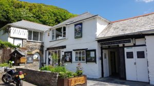 After this tour de force it mainly goes down with some steep slopes before I am in Boscastle. There are a lot of people in Boscastle, which is probably because it is a bank holiday in England today. At least I manage to get a spot in the beer garden to drink a pint.
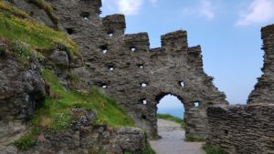 After I have also replenished my water supply (which is going very fast today with the warm weather), it goes on to Tintagel. It also immediately goes up again. After that it keeps going up and down with a few steep descents and rises. Eventually Tintagel Castle comes into view, or at least the remains of it. I left this morning extra early because I want to pay a visit. This visit also brings a number of altitude meters with it because the castle and everything that goes with it lies on two hills. But that does not stop me, I can handle the few extra meters.
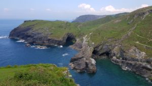
 Summer weather today, sunny the whole day. There were clouds to see, but they were further away. Actually too hot to trudge up steep slopes. Fortunately, there was a nice sea breeze, which gave a bit of cooling.


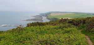
 Today a more relaxed route. Although there were a few climbs at the last section. Basically everything that a South West Coast Path walk should have:
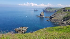
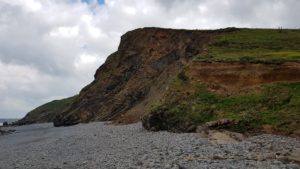 Something more about those rocks. The rocks are about 300 million years old and made up of the sedimentary rocks sandstone and shale (mud and other minerals). They were formed in the Carboniferous Period. Over the years the rock layers have become squashed and folded by the movement of the earth’s crust (the tectonic plates) to produce almost vertical strata in some places.
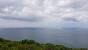 And again perfect walking weather. Cloudy, occasionally sunny and a nice temperature. Although there were occasionally dark clouds, it has remained completely dry.


 This is my 10th walking day on the South West Coast Path. And a heavy stage is up for today. All documentation that I have (see
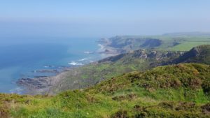
 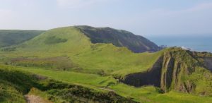 The first part is very relaxed, at least after the initial climb. I walk without too many height differences on top off the cliffs and through meadows. On top of the world.
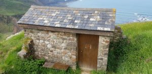
 Then I am suddenly caught up. That is special, usually I am the one who passes people. It is someone who runs the part that I am walking today. I thought I was sweating a lot, but he is soaking wet from head to toe. When we talk for a moment, there is a constant stream of fluid from his cap. Am I glad that I can walk.
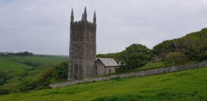 I was not planning to walk to Morwenstow, the route of today is long enough. However, there is a diversion because part of the Coast Path is impassable. This diversion is via Morwenstow. So if I am already there, then it is time for coffee at the Rectory Farm Tearoom.
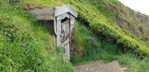 And again I come across a hut, a very small hut this time, Hawker’s Hut. This hut was made of driftwood by a local clergyman. And again to get inspiration for poems (or to smoke opium). I wonder which one it was…
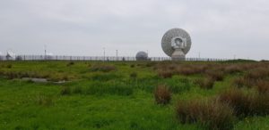


 Before I start my walk today, I first go down to the harbor in Clovelly. They are moving someone which means everything on sleds (cabinets, washing machine, everything) and down to the harbor . There is a road behind the hotel near the harbor.
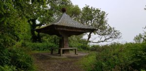 I also take this road and I return to the Coast Path near the Clovelly Visitor Center, after a long climb. I could have saved that climb, based on my overnight stay I could have used the Landrover service. But hey, no patience and so … Once on the Coast Path, a fairly relaxed walk follows through Clovelly Court Gardens with a hiding place called Angel’s Wings and a viewpoint to Blackchurch Rock.
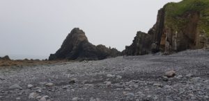 Then it starts going down a few times and back up again. The first time to the beach at Blackchurch Rock. I try to get a good picture of it (with the holes visible), but I can not. For that I would have to go into the sea and I don’t want to right now.
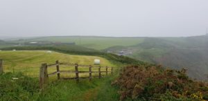 After a few drops and rises, another very relaxed part follows past fields along the cliffs up to Hartland Point. Here it is time for a break and coffee at The Hartland Point Outdoor Café where food and drinks are sold. They also have a terrace and fortunately they have a few parasols open so that I can sit dry (see weather below). They are open every day and certainly with this weather I think that’s very good service. On the other hand, half the terrace is full of walkers, so rain or shine, there is always something going on here.
 I only need to walk 4 – 5 kilometers, but these are heavy it says in the SWCP flyer. And they are right, the rest of the route is alternately laid back and then it goes down and back up again, up to 5 times.
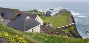 In the end the last climb is done and I see lying beneath me Hartland Quay. That’s where I need to be, that’s my stay for tonight.
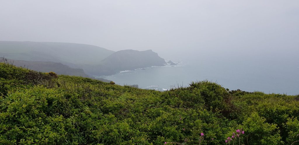


 After a relaxed part immediately after Westward Ho! it is really going up and down again and up and down … So a typical Coast Path route. All in all it is manageable. What really helps is that after the last big climb the descent is very gradual. That descent goes via the Hobby Drive, a road to Clovelly which used to be a toll road. The road is called that way because building the road was a hobby for Sir James Hamlyn Williams.
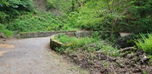 Halfway through the Hobby Drive I meet a lot of people at a viewpoint. One of those people is Davey, whom I also encountered in Ilfracombe a few days ago. We walk the Hobby Drive together for some time, until Davey wants to drop the pace again.
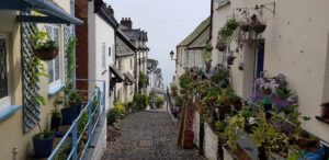
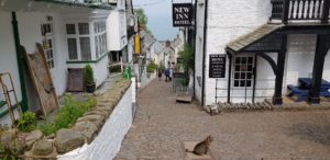 Clovelly waits at the end of the Hobby Drive. Clovelly lies against the hill and has a very steep main street of boulders. Motorized traffic is banned and all transport is through sledges or donkeys. My hotel is halfway up the hill and I am well on time. Even earlier than my bags. So I will have a local beer while waiting.


 The first activities of today were of a more domestic nature. Walk to the launderette and do the laundry. That went amazingly well, but I will spare you the details. And no, the lyrics of today do not come from Trafassi 🙂 (I am afraid that this one will elude most of my non Dutch friends, try looking up Trafassi and Wasmasjien and translate the song lyrics).
 After the housekeeping was done, it was time to walk to the coast (only a few hundred meters). There I started with all beach bars going from left to right (not that there are so many). Nicely laid back on the terrace, reading a little, working on this report and doing nothing (except watching people).
 Perfect summer weather to spend on the coast. Sunny all day and a nice temperature.


