Date: 20180711
Time: 9:35 -15:00
Distance: 19.5 km
Stay: Abbey House, Abbotsbury
Walk
After breakfast I first walk to the beach at Eype’s Mouth to look at the cliffs. Then I start walking.
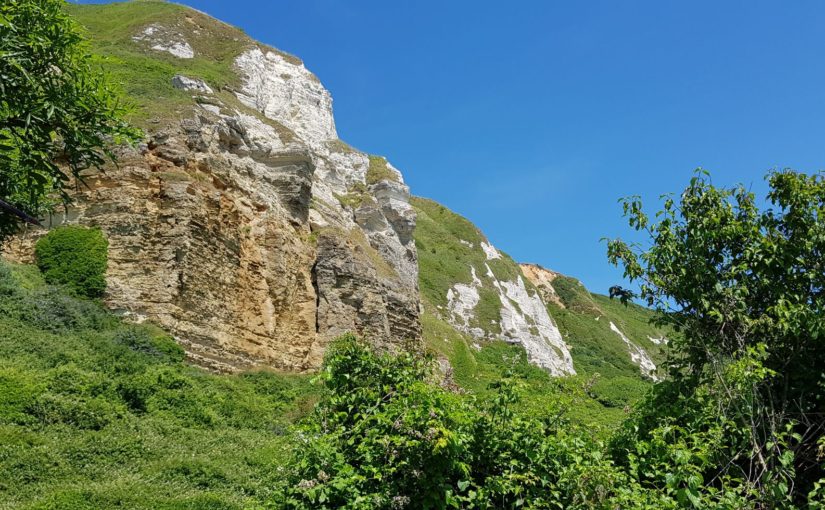
 In the beginning I have a few cliffs that I have to climb, but they are getting lower and lower. After a few kilometers and the first cliff I am in West Bay. Here I fill my water supply.
Then it goes up again. Although the cliffs are getting lower, they are steep. After a few more cliffs and a golf course, I arrive in Burton Freshwater. Here I have to cross the river Bride. The official route goes a bit inland over a bridge, but I do not pay attention and just cross at the beach. The water does not get higher than a few centimeters and I can walk through it.
I do another cliff and then I am in Burton Hive. Here it is time for a can of lemonade and a break at the beach café.
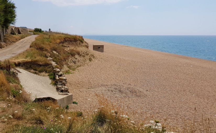
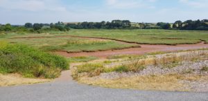
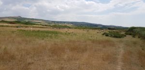 One last cliff and then follows a very long flat stretch along Chesil Beach. Chesil Beach is about 29 kilometers long (so I’m not rid of yet) and consists of all pebbles. That in itself is not so bad, if you do not have to walk over them. If the gravel layer is too thick, then there is almost no getting through. It is like walking on loose sand.
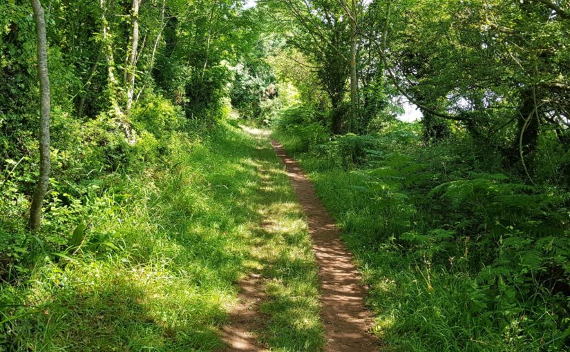
In the beginning I occasionally go a little bit on the pebble, that’s not a problem. Then follows a whole stretch that goes a bit from the beach, past the meadows. That is relaxed walking and because it is flat, making progress.
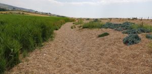 Unfortunately I return to the beach and follow a long stretch over and through the gravel. That is heavy working. The only way to bring some improvement here is to walk as much as possible over the vegetation that is occasionally there. When I get to a parking lot, I hope I’ve had it. Unfortunately, after the parking lot the gravel continues.
At a second parking lot, I am now 2 kilometers before Abbotsbury, I take a break at a shed where they sell ice cream and the like. An ice cream is nice after that heavy work.
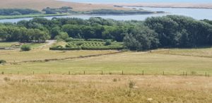 After this break, I have a small stretch of pebble and then it’s over for today. It goes again along ordinary hiking trails and also inland. I follow the Coast Path to the Swannery. In principle I wanted to go inside, but £ 12.50 to see a few swans is a bit too steep. The rest of the Swannery is probably nice, but more aimed at children.
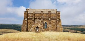
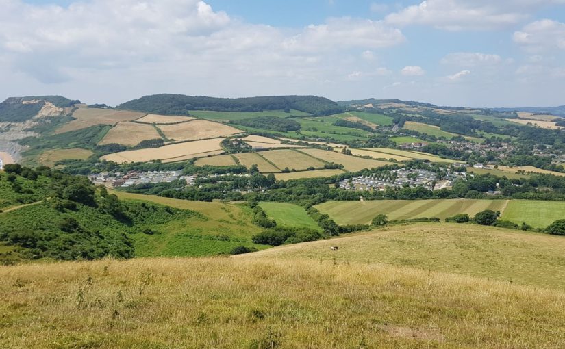
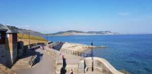
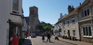
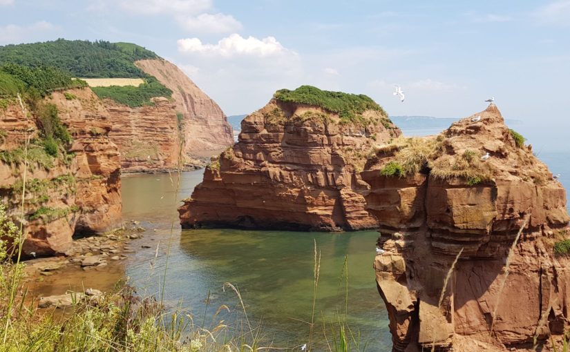
So it goes towards the village and the chapel of St. Catherine. That chapel is on a hill and I walk there first. From the top of the hill you have a great view in all directions.
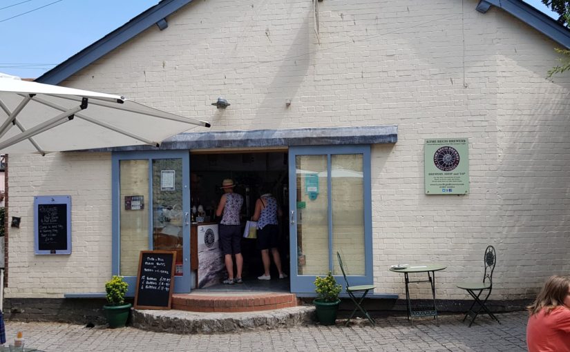
After I have looked at the chapel and enjoyed the view, I walk down to the village again. At The Ilchester Arms I take a pint and then it goes to my overnight address for today.
All in all, the first part of today was a great walk and the second part a little less. That was mainly due to the plodding through the pebble.
Weather
Great walking weather, sunny and later in the day also cloudy. That keeps the heat away a bit. Of course it was dry. That is also visible on the ground.
Lyric of the day
Today I walked a lot about pebbles / stones and they rolled away under my feet. If I didn’t watch out, I myself would have rolled away… Therefore today Papa Was A Rollin’ Stone by The Temptations:
It was the third of September
That day I’ll always remember,
Yes, I will
‘Cause that was the day that my daddy died
I never got a chance to see him
Never heard nothin’ but bad things about him
Mama, I’m depending on you
To tell me the truth
Mama just hung her head and said, “Son,..
Papa was a rolling stone.
Wherever he laid his hat was his home.
And when he died, all he left us was alone.
Papa was a rolling stone, my son.
Wherever he laid his hat was his home.
And when he died, all he left us was alone.”
Hey, mama!
Is it true what they say that papa never worked a day in his life?
And, mama, some bad talk goin’ round town sayin’ that papa had three outside children and another wife,
And that ain’t right
Heard them talking papa doing some store front preachin’
Talked about saving souls and all the time leechin’
Dealing in debt and stealing in the name of the Lord
Mama just hung her head and said,
“Papa was a rolling stone, my son.
Wherever he laid his hat was his home.
And when he died, all he left us was alone.
Papa was a rolling stone.
Wherever he laid his hat was his home.
And when he died, all he left us was alone.”
Hey, mama,
I heard papa called himself a “Jack Of All Trades”
Tell me is that what sent papa to an early grave?
Folks say papa would beg, borrow, steal
To pay his bills
Hey, mama,
Folks say papa never was much on thinking
Spent most of his time chasing women and drinking
Mama, I’m depending on you
To tell me the truth
Mama looked up with a tear in her eye and said, “Son,..
Papa was a rolling stone (well, well…)
Wherever he laid his hat was his home
And when he died, all he left us was alone
Papa was a rolling stone
Wherever he laid his hat was his home
And when he died, all he left us was alone.”
I said, “Papa was a rolling stone (yes, he was, my son)
Wherever he laid his hat was his home
And when he died, all he left us was alone
My daddy was (papa was a rolling stone), yes, he was
Wherever he laid his hat was his home
And when he died, all he left us was alone.”


 I walk to the village first and on the way I fill my water supply at the Co-op. Then it continues along the sea and soon also up. Through a number of fields and a forest.
 Unfortunately, there is a diversion. Once again a cliff has fallen down and as a result they had to move the Coast Path. This diversion goes for a large part along the road and for a large part also along a busy road. There is a part that is easy going, right across a golf course. However, that is annoying for the golfers. Normally I walk along the edge of a golf course, here I walk right through it and a few golfers have to wait until I pass.
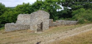 Eventually I arrive at the top of the cliff at Stonebarrow. From here everything is going to be better. Now follows a nice piece of cliff walking. Before I start the climb to Golden Cap, I decide to walk off the route to walk through Stanton St Gabriel, a tiny hamlet from the 13th century.
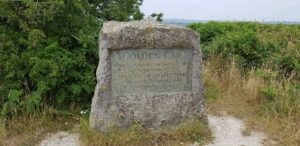
 The descent of Golden Cap is fairly easy, to Seatown. Here it is time for coffee at the beach shop. I still have a bit to go (and to climb) before I get to Eype’s Mouth, where my hotel is for today.
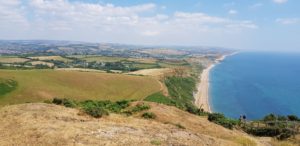


 Today is all about the English jungle. But before that happens, I first go into the local store in Beer to get a lot of water. It is very hot again and I don’t want to run out of water today.
 After getting the water it goes up immediately. I have one more cliff to go and then I come to Seaton. Seaton is only a short distance away from Beer (but with a cliff in between). In Seaton I follow again the promenade, the route along the beach.
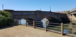 At the end of Seaton I leave the coast for a bit to cross the river Axe by the oldest concrete bridge in England, the Axmouth Bridge (1877). Then it goes up steeply to a golf course. I walk right through it and then I come to the point of no return. A sign warns me that the next piece is 3.5 to 4 hours walking and that there are no possibilities to go to the sea or inland. In other words, if you start this, then you have to finish it or go back.
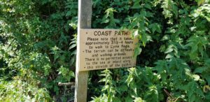 I consider all options and check that my jungle equipment is complete. After much deliberation I decide to take a chance and I go in to the jungle. The jungle we are talking about here is the Axmouth – Lyme Regis Undercliff, an area where in the past several landslides have taken place (read cliffs falling down). Because the area is too unstable, man has never really intervened. This has led to a green area that is unique in England. The Coast Path goes right through it, a route of about 13 kilometers.
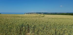 The first part goes past fields and over cliffs and is in general rather disappointing with respect to jungle. But then I come to a sign that describes the Undercliff and from there it is indeed through the jungle. Everything is green and grows together here. It is also humid here, despite the drought elsewhere. There is a great diversity of plants and trees. In the end, I distinguish two types of terrain. Where there are no large trees, everything is overgrown with shrubs and other low plants. Where there are large trees, the ground can still be seen and there are more ‘open’ spaces.
 To make it easier for walkers, they have build a tower halfway. That’s handy, so you know you’re halfway through. Here is also a road and there is even a car parked. It is not so remote here.
 Now there is still a stretch along the beach of Lyme Regis. Here it is very busy, good weather and Sunday. At the Rock Point Inn I stop for a pint on the terrace. Then I walk up the hill to my hotel for the next two nights.
 All in all today was a completely different experience than the Coast Path so far. Certainly nice for the variety. What I found disappointing about the jungle was the amount of flowers. According to the descriptions many (unique) flowers grow here. I did not see them, everything was green and there were only few flowers. Probably the wrong time of the year.
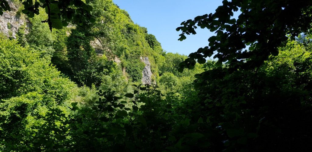 Well, I ran a bit through the jungle today, therefore


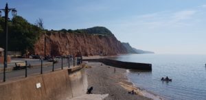 I start on a relaxing route today. Along the beach in Sidmouth. However, that is short-lived, after the beach it quickly goes up to Salcombe Hill. That is the first of three big climbs that I have to deal with today. Fortunately they are all three in the beginning of the route.
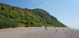 But at Weston Mouth it goes down again, completely this time, down to the beach. And immediately up again. This is the last big climb today. What follows is a lot of cliff top walking where I slowly walk down. It goes through meadows and there are quite a lot of people. That is probably because it is Saturday.
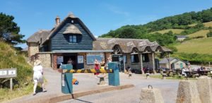 When I arrive at Branscombe Mouth, it’s time for a break. Fill-up the water supply and a can of juice. Because I did the worst of today and because today is a short route, I decide to walk to Branscombe village. There are some nice cottages and there is a pub somewhere.
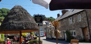 When I walk to the second hamlet via the road, I find the Masons Arms there. That is good, a pint on the terrace in the shade seems nice to me.
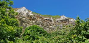 After this welcome break I find my way back to the Coast Path. That is not very difficult and once arrived at the coast, I follow the lower cliff path along Hooken Cliff. That does not mean that I do not have to walk up, but only that I first walk underneath and only then climb up. However, it is not such a big climb (relatively speaking).
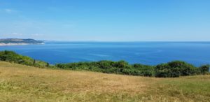 I now walk around Beer Head. At the beginning I can look back completely to Start Point (I was there a week ago). When I walk around Beer Head, I can look all the way ahead and see the largest part of the Coast Path that I still have to walk, all the way to Portland.
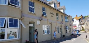 From Beer Head it goes quietly down to Beer. Fantastic name for a village in England 🙂 Here I go straight to the Anchor Inn, my address for the night. That’s good, because here they have a Beer Garden and life music. After my pint I check in and I take a shower. In the meantime, England starts the match. When I’m done and want another pint, I have to find my way between football fans who are all staring at a (rather small) screen (and all in front of the bar of course). I sit outside in the Beer Garden again and start this report. In the end, I think England won …


 I start today with a long walk along the beach (not over) in Exmouth. I walk all the way to the end and there it goes up. From here it goes over narrow paths and through meadows to a large holiday park. I have a good view of the next part of the route, it goes up again before I am in Budleigh Salterton.
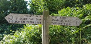
 At the end of the sea wall, I arrive at the river Otter. There is no ferry here, but the Coast Path goes via the first bridge that lies a bit inland. A few kilometers flat walking along the river estuary.
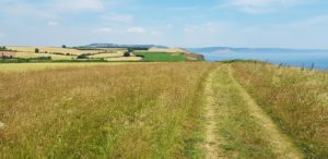 When I get back to the coast, it goes up and then follows a fairly flat stretch where I at some point in the distance see the real challenge of today, High Peak / Peak Hill.
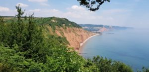 After I have walked through another holiday park, I begin this challenge. It goes up to High Peak and the last part is very steep. Then follows a flat section and then it goes up to Peak Hill. All that on the last kilometers of the route.
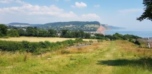


 Today I have a long and varied day ahead. The first piece is pretty heavy, after that it is not too bad. I also have two ferries, one on the Teign and one on the Exe. Especially the latter, at the end of the walk, I have to get. Officially the last one is always at 16:10 and in the season (now) at 17:10. But apparently the last one is sometimes skipped when there are no passengers. Well, today that will probably not be a problem, but I’m definitely aiming for the 15:10 one.
 But first the tricky part. From Babbacombe to Teignmouth it goes over the cliffs and it’s constantly going up and down. Normally when you walk up, you stay there for a while before you go down again. But not today. When I am up, it immediately goes down again and when I am down, I immediately go up again. That’s what they call wearing out…
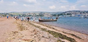 When I arrive in Shaldon, that is fortunately over. There I take the first ferry to Teignmouth. The ferry arrives just as I arrive at the beach.
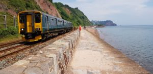 Then the route is characterized by long flat sections and occasionally a hill. Those long flat sections consist largely of two sea walls that I walk over, 1 in Teignmouth and 1 in Dawlish. That is possible because it is low tide. Both sea walls run between the railway and the sea. Once you start, you can only finish them or go back.
 When I arrive at the river Exe, I think I am close to the ferry. However, that is disappointing, for that I still have to walk 4 kilometers. The stretch is completely flat. It goes along the Exe Estuary Trail, until I am in Starcross. The ferry leaves there. When I arrive, I just see the ferry of 14:10 departing. No problem, close by there is The Atmospheric Railway Inn and I go inside for a pint.
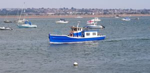


")


")


 Na een tijdje kom ik bij Brixham Battery uit, alweer een verdedigingswerk uit de tweede wereldoorlog. Hier hebben ze er ook een militair museum bij gemaakt. Dat is in principe een groot woord voor het kleine gebouw en de paar oorlogs artefacten die ze buiten hebben staan.
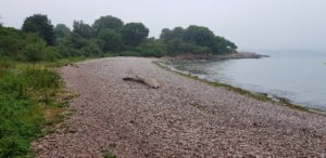 Even verder kom ik bij Elberry Cove. Hier loop ik over de pebbles en daarna verdwijn ik in het bos. Het gaat nu een flink stuk door het bos. In principe een lekker stukje lopen. Maar wel goed het pad in de gaten houden. Want behalve de normale stenen en rotsen, moet ik nu ook uitkijken voor boomwortels. Gevaarlijke dingen die boomwortels, als je niet uitkijkt springen ze zo voor je voeten…
 Nadat ik langs diverse stranden ben gelopen, kom ik in Paignton. Hier is helaas alles dicht, ook de Inn on the Quay. Begrijpelijk met dit weer, maar niet wenselijk. Gelukkig is er koffie te krijgen in de beach shop. Hier kan ik niet zitten, maar wel even schuilen. Het is namelijk weer begonnen met regenen.
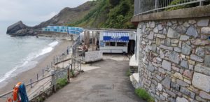 Na Torquay gaat het weer meer de natuur in. Bij het beach cafe op Meadfoot Beach is het weer tijd voor een kop koffie. Hier kan ik wel zitten, buiten wel te verstaan, maar dat is nu geen probleem, het is droog.
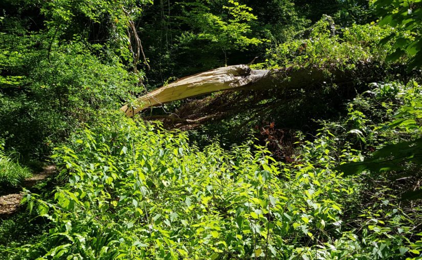
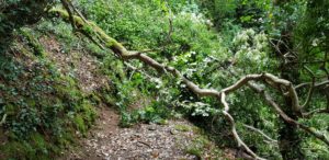 Na Meadfoot Beach gaat het naar Hope’s Nose en vanaf daar volgt weer een flinke boswandeling. Dit is wel relaxt wandelen, totdat ik bij een boom uitkom die nog maar pas over het pad gevallen is. Ik bekijk de opties en besluit om onderlangs te gaan. Je kunt zien dat dit nog maar pas gebeurd is. Afgezien van het feit dat de boom anders al opgeruimd zou zijn, is er nog geen echt alternatief pad ontstaan.
 Als ik uit het bos kom, ben ik op Babbacombe Beach. Hier is het tijd voor een blikje drinken bij het strandtentje. Van Babbacombe Beach ga ik via een trappenstellage en een stukje bospad naar Oddicombe Beach. Hier gaat een klif baan omhoog. Ik volg deze een stukje omhoog, totdat het Coast Path afdraaid.
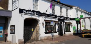
 Uiteindelijk ga ik weer helemaal omhoog de klif op. Daar verlaat ik het Coast Path om naar mijn B&B in Babbacombe te lopen. Als ik Babbacombe in loop, zie ik groot ‘Platform 5 Brewing Company’ op een gebouw staan. Een pub waar ze bier van een onbekende brouwerij hebben, tja daar kan ik niet aan voorbij gaan.
 Weer een grijze dag. Nog voordat ik Brixham uit was, begon het al te regenen. Dat ging later over in miezer regen. De rest van de dag bleef het erg grijs en af en toe viel er regen of motregende met. Weinig wind vandaag.


")


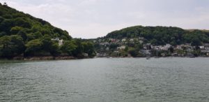
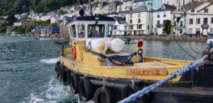 The day begins, as often happens on this side of England, with a ferry crossing, over the Dart this time. There are several possibilities, but I opt for the lower ferry and not the passenger ferry. The only difference is the starting point, they arrive at the same point on the Kingswear side.
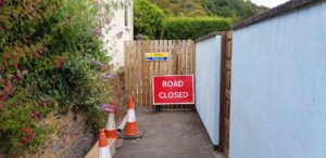 When I arrived in Kingswear I pick up the Coast Path again and I walk past a number of (holiday) houses. Somewhere I probably missed a sign because a moment later I can not continue. The path has been closed. So a bit back and then try again on the road a little higher up. There are Coast Path markings on that road. The old path has been closed due to an unstable cliff.
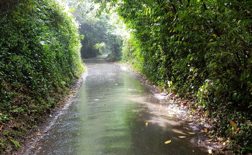
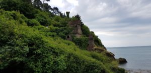 When I’m out of Kingswear, it starts to rain. I walk under the trees and stay there for shelter. It is pouring, but fortunately the trees catch everything and I stay dry.
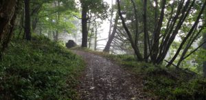 I think I got off well, but I’m wrong. A little later it starts to rain again. I still (or again) walk under the trees, but this time they do not stop everything (but a lot). Eventually I still get wet, although my pants remain largely dry. And all that without a coat …
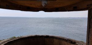
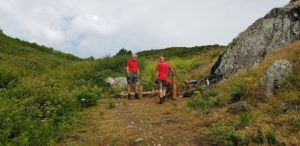 The path is being worked on. Three men are busy making the first step for a ‘staircase’. I have a chat with them and tell them that I am walking the entire Coast Path. Then they want to know if this part is the most beautiful part 🙂 To which I answer tactically that all parts are beautiful, but all different.
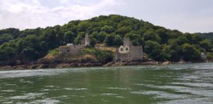
 From Sharkham Point the height differences get easier and it continues a bit more on the same level, with gradual (and small) height differences. A little further at Berry Head it starts to rain again, fortunately just for a moment. On Berry Head you can see the remains of a large fortress from the time of Napoleon. Normally I would have made time for that, but given the weather I continue.


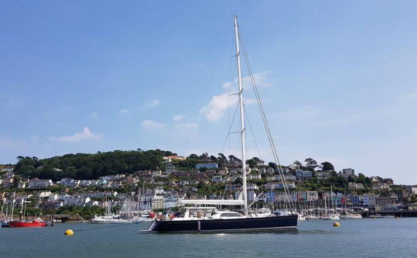
 And another rest day today, in Dartmouth this time. The last two rest days I was lucky because they had a laundry service in the hotel where I stayed. Today I have to go to the launderette myself, but I’m lucky again. The woman that runs the launderette offers to do the laundry for me (against payment of course). No problem, I like that. Now I do not have to stay in the launderette until everything is ready.
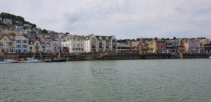 Instead, I explore Dartmouth a bit and visit the tourist information to see what there is to do. There are possibilities to make a boat trip, That might be something for the afternoon.
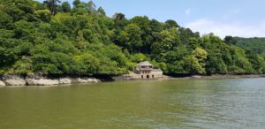 But first I’m going to get the laundry again and then I eat a soup in a pub, with a pint of course. After lunch I go to the quay and am just on time to board the paddle wheel boat that will make a ‘cruise’ of about one hour over the river Dart. First a bit in the direction of the sea to the estuary and then quite a bit upstream, past the house where Agatha Christie lived (Greenway House).