Date: 20180610
Time: 9:15 – 16:45
Distance: 21.8 km
Stay: Rockridge House, Porthcurno
Walk
After a good breakfast at the golf club, I first go to Cape Cornwall. Until about 200 years ago, Cape Cornwall was thought to be the westernmost point of Cornwall. Only when the Ordnance Survey charted everything, it became clear that this was not the case, but that this is Dr. Syntax’s Head at Land’s End.
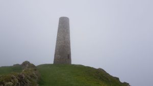
 There used to be a tin mine on Cape Cornwall and the chimney is still there as an aid to naval navigation (in the old days).
In 1987 Cape Cornwall, in honor of the 100th anniversary of Heinz, was purchased by Heinz (the ketchup and the baked beans guys) and donated to the National Trust. Probably as a thank you for the many baked beans served at the English breakfast…
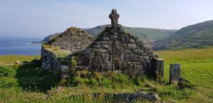
On Cape Cornwall you can also find the ruins of a small medieval chapel, St Helen’s Oratory.
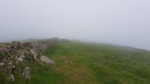
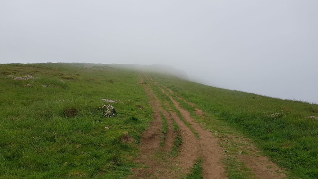
 After I walked around Cape Cornwall, it continues along the Coast Path. The path is no longer as uneven as the last two days, but later in the day there will be some climbing parts.
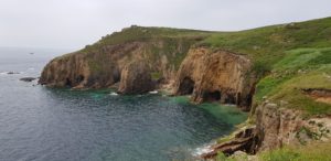
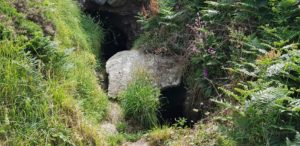
I do, however, encounter many caves today, both in the sea and on land. It looks like cavemen country here. Some of these caves are closed, but a large number are open. Since I do not feel like dabbing around in the dark, I walk past them all 🙂
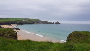
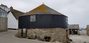 After a while I arrive at Sennen Cove. Here is a large beach and a lot of people are surfing. For me it’s time for coffee at the Beach Bar. Then I take a look at the harbor, with the capstan house, and walk to the coastguard lookout at Pedn-men-du.
A capstan house was used to pull boats up the slipway.
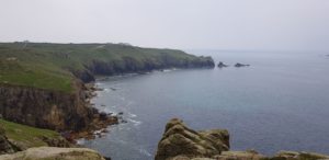
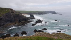
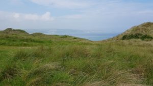
After Sennen Cove I arrive at the busiest part of the Coast Path, between Sennen Cove and Land’s End. It is not that bad today, despite the fact that it is Sunday. The coast is beautiful here and you have beautiful views.
What is also striking is that there is indeed a different kind of people walking here (who mainly come by car). Normally I greet everyone and that is mutual, good morning, good afternoon, hello, hi. I do that now too, but I only rarely get a response. Many people do not even look up.
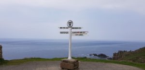
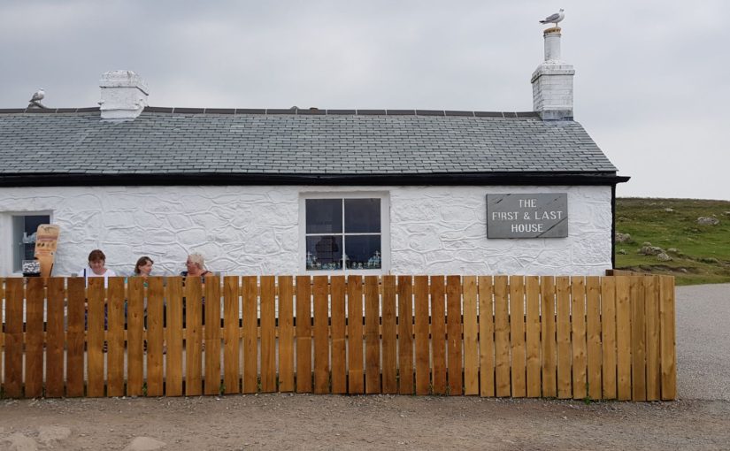
When I’ve seen the first and last house at Land’s End, it’s time to celebrate this milestone with a pint. I do that at the Land’s End Bar & Restaurant. I’m obviously looking for a beer that I haven’t had yet, a New Zealand beer this time, Silvetip from the Beerd Brewery. Unfortunately, they only have a little more than half a pint. My luck, they are out of beer… But not to worry, I’ll do with half a pint this time. I still have to walk a few miles.
After Land’s End there is a small stretch that is still a little bit busy, then after that the peace returns.
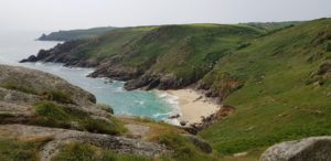 The piece from Sennen Cove to Land’s End and a bit further I did with Ada and the kids in 2009 as part of a circular walk. Land’s End became more touristy during this time than it already was. The bench at the first and last house is gone and there is now a fence. A shame!
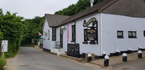 It is still some work to get to Porthcurno. Once there, I first go to the Cable Station Inn for a pint. Then to the B & B for a shower.
Weather
Fortunately, today it was not as hot as yesterday. It started out sunny, but later on, clouds were passing. Pleasant temperature and dry. What more does a walker want?
Lyric of the day
 Because of the large number of caves today, we go on the experimental / psychedelic tour. Today I have chosen a song text that is quite different. It is in any case the song with the longest title of the group. I found the best explanation about the meaning of the text on the blog of Pink Floyd Lyrics.
It is Several Species Of Small Furry Animals Gathered Together In A Cave And Grooving With A Pict by Pink Floyd:
Aye an’ a bit of Mackeral settler rack and ruin
ran it doon by the haim, ‘ma place
well I slapped me and I slapped it doon in the side
and I cried, cried, cried.
The fear a fallen down taken never back the raize and then Craig Marion,
get out wi’ ye Claymore out mi pocket a’ ran doon, doon the middin stain
picking the fiery horde that was fallen around ma feet.
Never he cried, never shall it ye get me alive
ye rotten hound of the burnie crew. Well I snatched fer the blade O my
Claymore cut and thrust and I fell doon before him round his feet.
Aye! A roar he cried frae the bottom of his heart that I would nay fall
but as dead, dead as ‘a can be by his feet; de ya ken?
And the wind cried Mary.
Thank you.


 Long ago a beautiful and well-dressed woman occasionally attended the services in St. Senara’s church in Zennor. The parishioners were impressed by her beauty and her voice, because her singing was the best of all. She appeared infrequently for years, but never seemed to grow older and nobody knew where she came from. After many years, the mysterious woman became interested in a young man named Mathey Trewella, “the best singer in the parish”. One day, he followed her home and disappeared; neither was ever seen again.
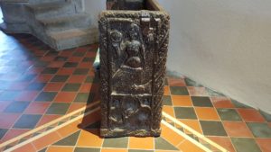 The villagers wondered what had become of the two, until one Sunday a ship anchored about a mile from Pendour Cove. Shortly thereafter, a mermaid appeared and asked if the anchor could be lifted as one of its flukes was resting on her door and she could not reach her children. The sailors did as they were asked and then went off like a (water) hare (ok, I know, bad translation but you get the idea), because the mermaid would be a bad omen. When the villagers heard this, they concluded that the mermaid was the same lady who had visited their church for a long time and that she had tempted Mathey Trewella to come and live with her.
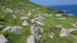 As soon as I am back on the path, it continues where I stopped yesterday. Not only as far as the route is concerned, but also as far as the path itself is concerned, very uneven and in the beginning a few climbs over boulders.
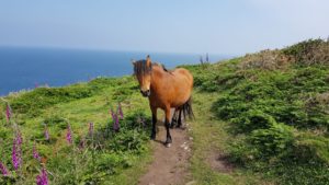 Now that I know what to look for, I often see seals in the water, even from larger distances.
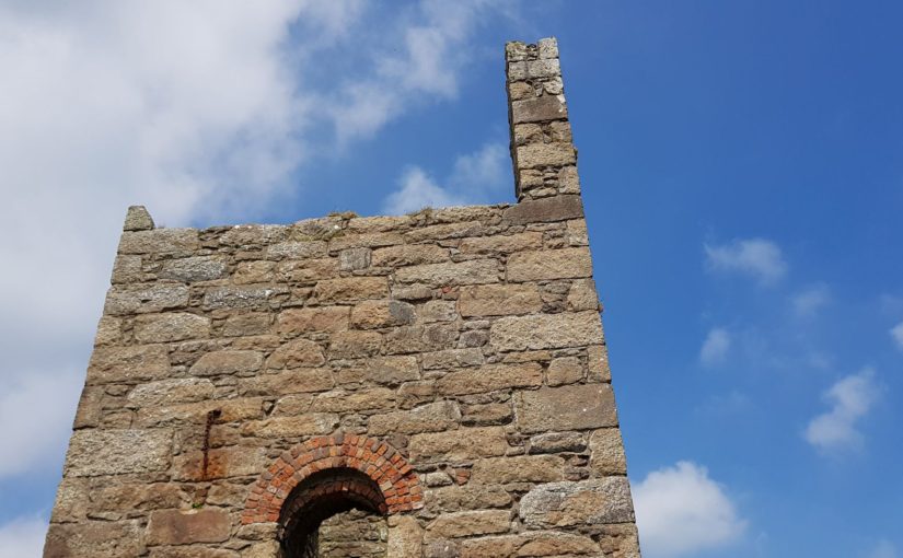
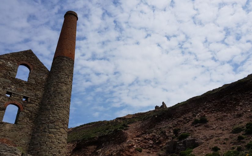
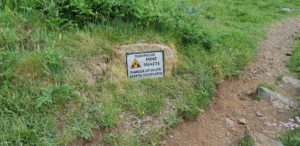 The theme of today’s walk is clearly mining. I come across many ruins of engine houses. There used to be a lot of tin mining here and that is still clearly visible. Apart from the remains of the buildings, there are also many remnants of that mining below my feet. The mine corridors and shafts are still there. For those shafts I am regularly warned by signs.
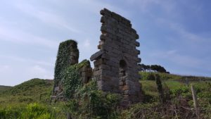 I am a little low on water today because I could not replenish my supply in Zennor (only glass bottles, more glass than water). So if I get the opportunity to refill that, I take it. This is after about 13-14 kilometer. Then I make a detour to Pendeen. Here is a supermarket and there I fill my water supply and I also have a break. A bit further is a pub, but I control myself. With this warm weather it is better to postpone the beer drinking until later when I’m done walking.
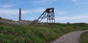 When I walk back to the Coast Path from Pendeen, I walk straight through a mine area, the Levant mine. Part of the Coast Path goes through this too (that’s where I am heading), but I also walk through the real industrial part when I come from the village. This would never be possible in the Netherlands. An old industrial area where you can just walk through. In the Netherlands it would already have been cleaned up (gone with the heritage) or a large fence would have been placed around it. Imagine that something happened…
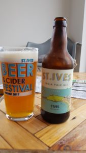
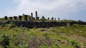 Without tin from Cornwall, 4000 years ago in Europe there would have been no bronze age, but a copper age (tin and copper together form bronze). So there is already 4000 years of mining in Cornwall. During the beginning of the industrial revolution (around 1820), the Levant mine started participating in the tin and copper mining. The corridors went up to 550 meters below the seabed and 1.6 kilometers from the cliffs into the sea. The miners in this mine under the sea were a kind of tenant, ‘working in tribute’. That explains the name of one of the popular beers of the St Austell brewery, Tribute. Another popular beer from St Austell (a delicious IPA) is called Proper Job …
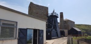 The ore carts in the mines were pulled by ponies that lived underground day and night and were well cared for. So good, that by the time they retired and came back above the ground, people were eager to buy one, with their good condition they won all the popular horse races.
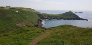 After the mining area, it continues along the Coast Path towards Cape Cornwall. I did see it, but I turned to St Just before reaching it to get to my overnight stay. Tomorrow more about Cape Cornwall.


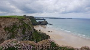
 The challenge for today was not in the length of the walk or in the height differences. The challenge was in the Coast Path itself. The path was very uneven and especially after River Cove it was much about rocks and boulders. So climbing, watching where you put your feet down and occasionally with hands and feet.
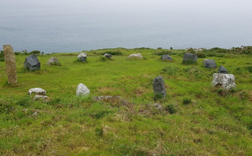
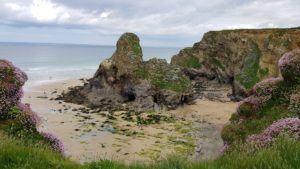
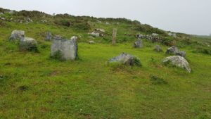 After Polgassick Cove I came to the Trevalgan stone circle, the Merry Harvesters. According to legend, some old farmers from the area danced here on a Sunday with a virgin and then turned into stone.
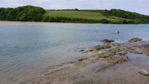
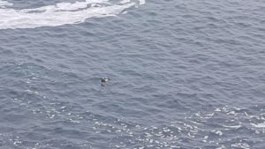 At River Cove it was time for a break. An ideal place because I could spot seals again. This time one was close enough to take a picture. This is not the best picture, but still.
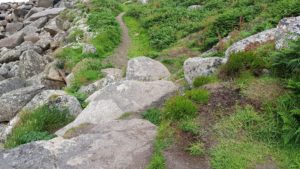 After River Cove the most exciting part of today’s hike started. So far, the path was not very even, but was good to walk and not much different than on other parts of the Coast Path. However, that became different now, big parts went across the rocks and occasionally real climbing was needed to get along. Tiring, but fun.
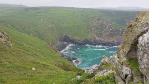 Finally, it went around Zennor Head and then it was time to go to Zennor. That lies a bit more inland.


")


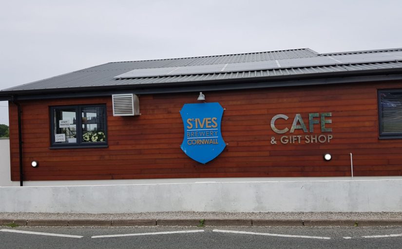
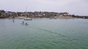


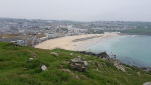
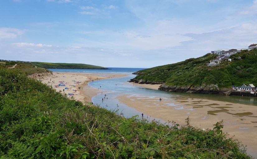
 Today I go to St Ives and there I have a rest day tomorrow. We, Ada, the kids and I, have been in St Ives before, during our holiday in Cornwall in 2009. Then we were playing with the surf on the beach in the harbor of St Ives, without being aware of that we were trapped by the sea when the flood came. Eventually we had to flee through the water (not too deep) to the dry part. Much to the entertainment of the bystanders who were all watching with interest (studip tourists …).
 The first 2.5 kilometers I need to get back to the Coast Path. The B & B was this time a long way inland. But it was worth it (as the sign said), a nice address on a farm, really old English establishment, a good-natured landlady who came to pick me up in the village in the evening so I did not have to walk the whole stretch again and a very good English breakfast (with mainly things from the farm).
 The landlady also had a good recommendation for a book, 500 Mile Walkies by Mark Wallington, about someone who also walked the Coast Path and wrote a book about it with a lot of humor. The book is out of print, but I ordered a second-hand copy via Amazon. Seems nice to read, not only because of the humor, but also because I know all the places he writes about by the time I read it.
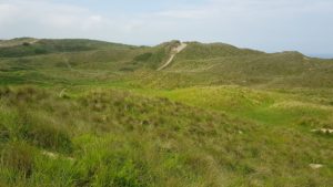
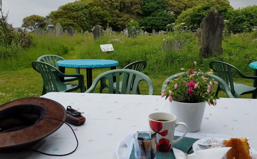
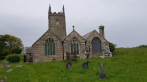 Eventually I arrive at the St Unys Church with a great graveyard. This graveyard is largely overgrown. There are many old graves, some with Cornish Crosses (if you want to search for this, look for ‘cornwall’ and ‘cross’, otherwise you only find chickens). There is also a St Uny Lelant Heritage Center with lots of info and a terrace. Yeay, coffee and cake in the graveyard. Nice and quiet…
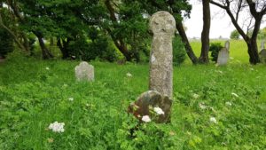 The majority of the graveyard is mowed once a year, except for the methodist piece, which they mow once every few weeks. The result is that there is a great environment for plants and insects. It is not for nothing a Living Churchyard.
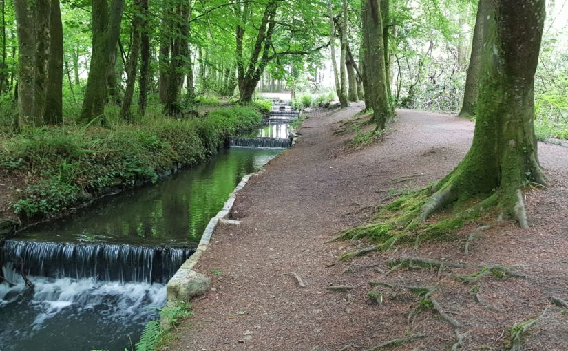
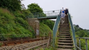 Then it continues along the railway to St Ives. First right, then left and then right again. Despite being close to the railway, the largest part is still a nice piece to walk. You don’t see the railway and only hear it when a train comes by (which does not happen that often).
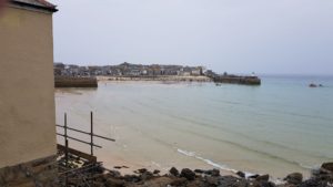 In St Ives it is very busy. Many tourists, but that’s what the town lives of.
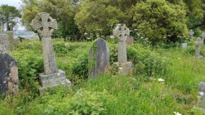


 Today I have an extremely short and easy walk ahead of me. That leaves time and space, so I decide to make an extra walk inland. I go to the Tehidy Country Park (thanks for the tip Damon).
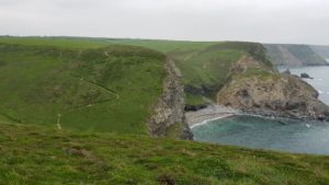
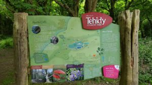 Then I arrive above Basset’s Cove. This is basically the extra walk that I have chosen. The walk comes from iWalk Cornwall, it is the
 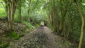 The extra walk is a nice change from the Coast Path, a nice walk through the fields and especially the forest in Tehidy Country Park. The gray squirrels here are very tame, they come right to you. Probably because they expect something to eat.
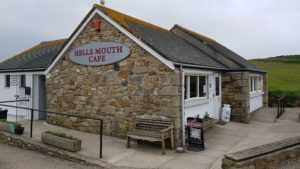 Back on the Coast Path I walk a bit of 1-2 kilometers that I already had before. Then it continues with an easy flat part above the cliffs. At Hell’s Mouth Café I take another break, I still have time enough. No coffee this time, but a cranberry juice.
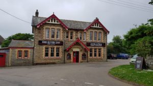 So I try that and that went fine. Through a dune-like terrain, a few fields and a campsite I arrive in the village, right at the Red River Inn where I wanted to go.
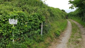 The trip to my B & B today is a walk in itself. Almost a half hour walk, in the middle of the fields. But well worth it, a beautiful room in real old English style. Unfortunately no wifi or mobile reception, but that is no problem, I have that here in the pub.


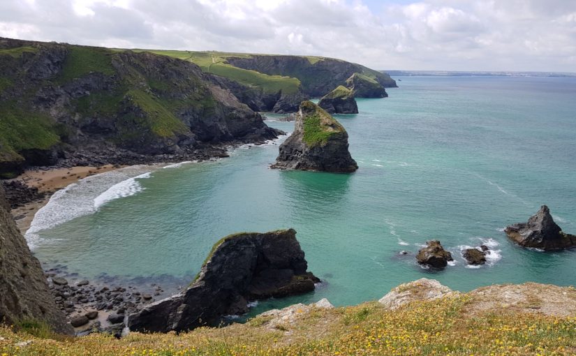
 The beach where I walked yesterday, is now fenced off. They are building 3 stages for
 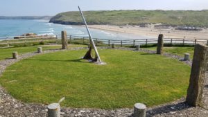 Just before I walk out of Perranporth, I pass a huge sundial. This indicates the time of Cornwall, so 20 minutes later than the usual English time 🙂
 This is visible from the remains of the mine buildings, the landscape and the closed mine shafts. It is interesting to see what people used to do with the landscape. Here and there are still mountains with excavated material. The mine shafts are closed with pyramid shaped structures. Let’s hope that nothing collapses when I walk over it.
 The last stretch goes for a large part along a fence. Behind that fence lies RRH Portreath or Remote Radar Head Portreath, a former site where chemical weapons were produced, including Sarin (hmm, that does ring a bell…). The site is owned by the MOD (Ministry of Defense). Despite the somewhat macabre history, this is a pretty boring part to walk.
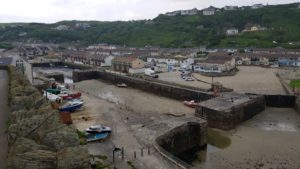 After the fence, however, Portreath quickly comes into view. A little further down to the currently dry harbor and my hotel is coming into view. I am really early today.
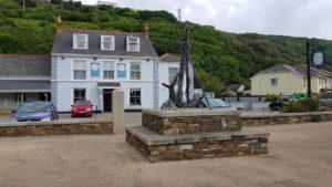 Unfortunately, I am way earlier than my luggage (I think). So I am forced to wait in the bar …


 The first challenge today is to cross the Gannel. There are a number of options. The easiest is the ferry, which leaves near my hotel. Then there are two bridges, which may or may not be under water, depending on the tide. Since I already walked part of today’s route to arrive at my hotel, today’s route is very short. So I go for one of the bridges. The first bridge is under water. So I try the next one (about a mile further).
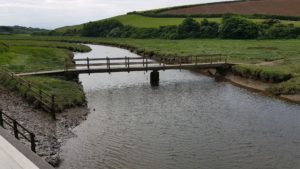 This bridge is passable and after crossing the Gannel, it goes back along that same Gannel. When I am back at the first bridge, I see that it is still under water.
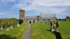
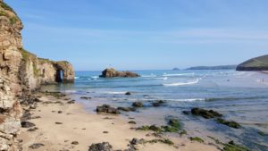
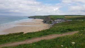
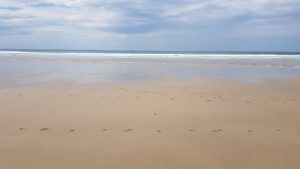 First I walk a bit over the beach, not the last time today, and then it goes up again for a regular stretch of Coast Path, above the cliffs. At the bottom the rock formations and the beaches alternate and before I know it I am almost at my final destination. The last part is also crossing the beach, the Perran Sands. This is a very wide (at least at low tide) and long beach. There are remarkably few people on this beach, probably because it is difficult to reach. After I have walked about a mile over this beach, I end up on a busier section. Here is also a good access to the beach and a lifeguard.
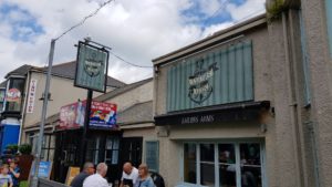
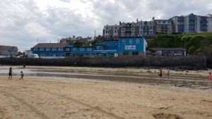 It goes up one more time and immediately down again and I am on Perranporth Beach (I could have stayed on the beach, but then I would have missed that last climb :-)). My hotel, the Seiners Arms, is located on this beach.
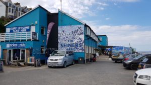 Arriving at my hotel, the first time this trip something goes wrong. They can’t find my reservation. My luggage is delivered, so that is not a problem. Fortunately they have a room and I get a family room (1x double bed and 1x bunk bed). Space enough.


 Nice summer weather today, sunny and with a strong breeze to the sea. There were clouds and occasional even dark clouds, but they didn’t bother much.


 From Padstow it immediately goes up and after that along narrow paths with lots of vegetation. This ensures that after a while I am wet again, even though it does not rain. But that is no problem, it will dry up over time. However, I am also covered with pollen, but that too is not a problem since they can be brushed off easily.