
Date: 20180630
Time: 9:20 – 16:10
Distance: 26.6 km
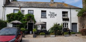
Stay: The Tower Inn, Slapton
Walk
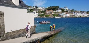
Today starts again with a trip on the ferry, over the Kingsbridge Estuary this time. On this side (the south side) of the Coast Path there are many more and larger rivers than on the other side (the north side). I have thought about it carefully, but the explanation is actually very logical. Water always looks for the easiest way, so down. If you look at the map of England, this side (the south side) is at the bottom. That is where the water flows. That is why there are so many rivers on this side of the Coast Path.
After the ferry crossing it continues in a relaxed way. Basically I have an easy day in terms of height. However, there are several parts with a difficult path, lots of stones and rocks in it and occasionally climbing over rocks.
At Gara Rock I take a diversion from the path to walk up for the view. As usual, that adds the necessary height meters to my walk.
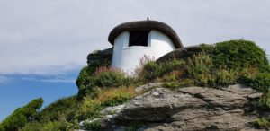
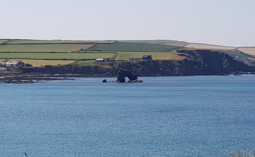
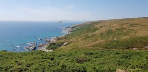
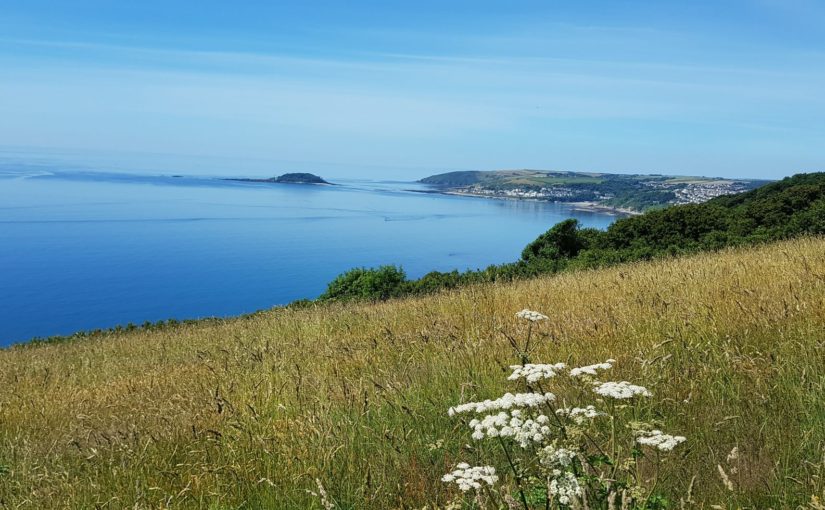
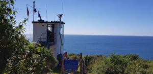
From Prawle Point, there is a Coastwatch station here, it goes down and then a few kilometers along the sea with the cliffs above it, a very flat stretch.
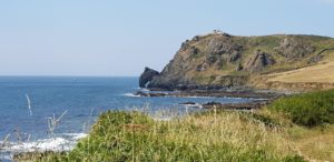
Under Prawle Point is a natural arch that only becomes visible when I look back.
Then it goes up again, although that is not too bad. When I walk back into civilization, I arrive at Hallsands, a village that disappeared into the sea in 1917 in a great storm. The ruins of the houses are still visible along the coast.
 I pass Hallsands and Lannacombe, but there is nothing to drink anywhere. Only in Beesand I come to the Cricket Inn, finally something to drink (I have enough water with me, but something else and cold is also appreciated).
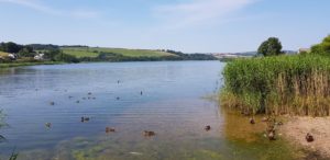 After that I have a few kilometers to go before I am in Slapton. The last part goes along Lower Ley and Slapton Ley. A rather boring stretch between a road along the beach and the largest natural lake in the south west. The path is very poorly walkable due to large sections with loose sand (I would have been better off walking on the beach).
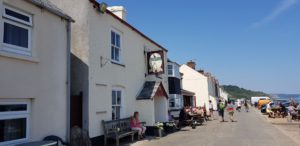
 Eventually I arrive at the Tower Inn in Slapton. It turns out to be closed … But luckily someone shows up so that I can go to my room. Shoes off, slippers on, backpack off and then back a few hundred meters. There was the Queens Arms and that was open 🙂
Weather
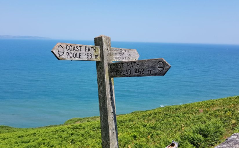
Sunny and warm, some clouds in the morning and later in the afternoon. A lot of wind again. The wind was not so friendly today. There were parts of the path, along the cliffs, where I could have walked without wind. At Start Point I was almost blown off my socks. Luckily there was plenty of room there.
Lyric of the day
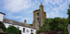 Today I stay at The Tower Inn, which takes its name from the remaining western tower of The Collegiate Chantry or St Mary (a group of priests who sang for someone’s salvation, in this case apparently in a nice building). So I took a lyric from the old days, Tower by Angel:
Wind is raw, the air is stale
On this cold winter’s night
Sent alone to tell a tale
From the land of Delmite
Journey starts at the edge of town
With the stars as my guide
There’s no one here but my empty thoughts
And the sword by my side
Just a light, from a tower
Burning on from dusk to dawn
Just a light, from a tower
Burning on from dusk to dawn
Sun is leaving the darkened clouds,
As it slips past the hills
Slow moon climbs way up in the sky,
Keeps the heavens so still
Come this far, though I know not why
Said the things I’ve been told
Greedy village that has sent me here
For it’s own pot of gold
Just a light, from a tower
Burning on from dusk to dawn
Just a light, from a tower
Burning on from dusk to dawn
Everywhere the wind did sail,
The castle lies just ahead
Blade is drawn, still I carry on
On my brow a cold sweat.
As I look there upon the hill,
There it stands so tall
Said that stone structured wall of gold,
Will heed the voice of us all.
Just a light, from a tower
Burning on from dusk to dawn
Just a light, from a tower
Burning on from dusk to dawn
Just a light, from a tower
Burning on from dusk to dawn
Just a light, from a tower
Stands the victor and his gold,
And that’s all!!!


")


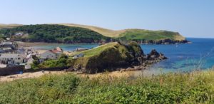 Today also starts very relaxed. I walk to Hope Cove, there are the villages Outer Hope and Inner Hope. Here are opportunities to have a drink, but it is still too early.
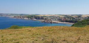 After Hope Cove it is done with relaxing. It goes up to Bolt Tail, but not too steep. From Bolt Tail you have a very nice view, mainly on the part that I have walked the last few days.
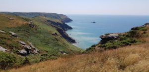 Once I am at the top, it continues with a relaxed part with relatively few height differences. But then it suddenly goes all the way down and pretty steep. And as it goes on the Coast Path, almost immediately straight up towards Bolt Head. During this climb I have to cover a narrow path right along the cliff edge. Fortunately, there is almost no wind on this stretch. That could have been quite annoying. The last part rises steeply against a grass slope, the wind is back at full strength and I walk against the wind. That is a hard part.
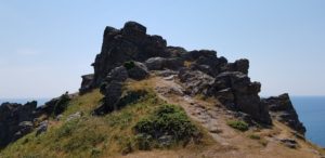 Then it goes on to Bolt Head in a relaxed manner. That is at about the same level and then just before it goes down again.
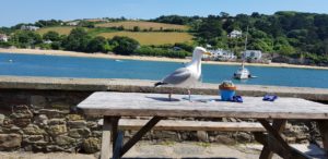 After Bolt Head it goes to Salcombe. A few kilometers through civilization and then a pint at the Ferry Inn.


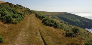 The start of today is easy, a long and wide grass path above the cliffs. Since the farm I stayed in last night was also on a high location, I do not even have to walk up. The view is once again great, in all directions.
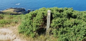 After a few kilometers of relaxed walking, I take an alternative from the Coast Path so that I pass the Church of St Peter the Poor Fisherman. As always, there is a price for this detour. It immediately goes down steeply and later I will have to go up again, the Coast Path continues relaxed at the same level.
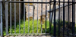 The
The 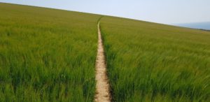 The wide grass path where I am now walking again, changes slowly and becomes narrower. There are also more gates that I have to go through and at some point it goes through meadows and fields again. One of those fields is very nice, a whole field full of wheat (knee high) with a narrow path through it. That looks nice.
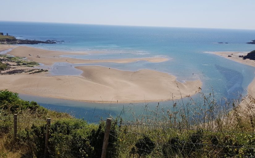
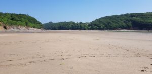 Well, and then I was standing in front of the Erm, a river that I had to cross. In principle you can wade this river one hour before and one hour after low tide. That was exactly at 1 o’clock today and I was there a little after 12 o’clock. Nice on time.
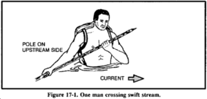 On the spot, I decided to take the guess and risk my life and wade through it. Where other hikers had failed, I would prevail. So I stripped down to my underpants, stuffed everything in the backpack and went barefoot into the water. I immediately felt the current and I was able to keep up with a lot of effort. Step by step it crossed the wild flowing river to the other side. The water stood up to my chest and I was able to keep my things dry over my head with great effort. Under my feet I felt razor-sharp stones that destroyed my soles. What did I get myself into…
 After the Erm it went to the next river, the Avon. The route became a lot heavier on this part, between the two rivers. It went up and down again and occasionally very steep. However, this was rewarded with even more amazing views than I had this morning. A lot of up and down usually also means a much rougher coast and that gives beautiful views.
 The result of all that climbing is that I start to get very hot. Luckily I arrive at Bigbury on Sea at one point and on the first occasion I stop for a pint of Guinness. That’s at The Waterfront, here they have Guinness Extra Cold, that’s good. I can use that now.
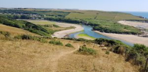
 I know approximately
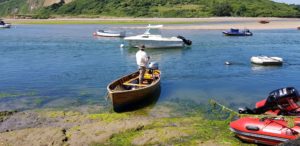
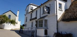 While we are having a chat, the ferryman takes me to the other side. I only have to walk a little bit up to the village to find the Sloop Inn.


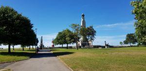 After breakfast I first go to the Tesco around the corner to replenish my water supply. Then it goes through Hoe Park and past the Smeaton’s Tower towards the Barbican.
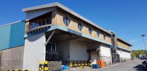 Then it goes all around all the water that they have in Plymouth to Mount Batten. That looks like a short walk, but is almost 10 kilometers. I could have done this with a ferry, it is not the most fun part of the Coast Path. But I do not want that. It is part of the Coast Path and so I walk it.
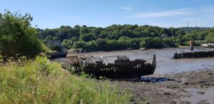 It is in any case something completely different, first through the entertainment district (because of a detour, the footbridge is closed because it is damaged), then through industrial sites (old and new, fishing / boats related and all kinds of other companies), the suburbs from Plymouth and finally a marina. On the way I come across several half or almost completely rotten boats.
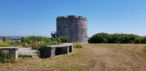 Eventually I arrive at Mount Batten, a few hundred meters from where I walked this morning (on the other side of the water). I also visit Mount Batten Tower, but unfortunately it is not open.
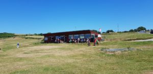 Now I come back on a part of the Coast Path that I am used to, through nature and close to the sea. At the Jennycliff Café I take a short break for a smoothie and after I have passed the Bovisand holiday park, I leave behind the last remnants of civilization, until to Wembury Beach.
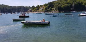
 The first piece goes up through a forest. That is nice with this warm weather, shade. Then it goes over a wide walking path further along the top of the cliff. That part is a bit heavy, in the full sun and after I have already walked that far. I keep going and finally I come to the place where I leave the Coast Path and head towards farm. I arrive there just before 4 o’clock, time for a shower.
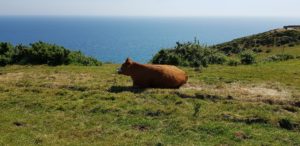 After I have showered, I walk for half an hour to the pub for a pint and something to eat. It goes downhill, so that is not so bad. I will not be walking that part up again, I will call Jackie (the owner of the B & B) to come and get me.


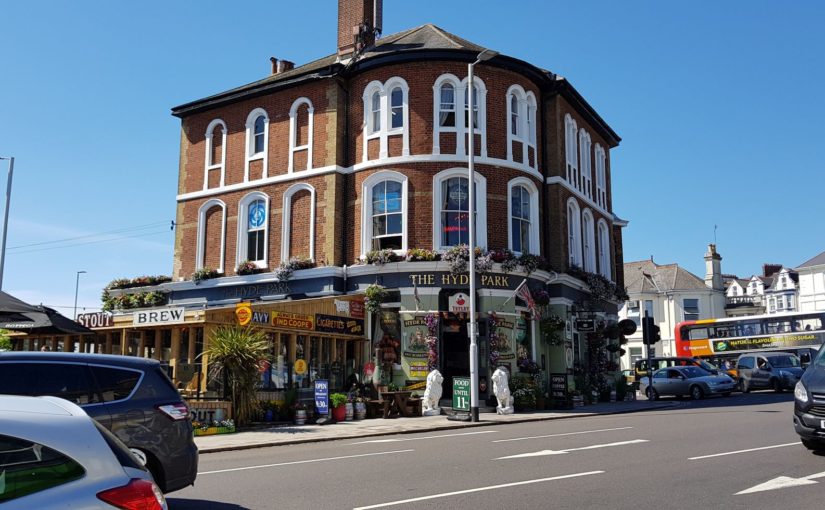
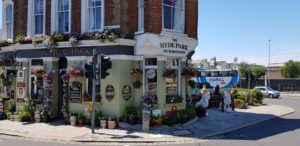 Then I go looking for The Hyde Park, a micro brewery. Unfortunately, there is no more micro-brewing being done. The equipment has failed and they have never restarted…


 The owner of the hotel tells me a shortcut. There is a shorter way from the hotel to the Coast Path than back where I came from. But then I miss a part of the path. In addition, I still want to walk through Crafthole to replenish my water supply at the local store.
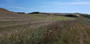 The first part goes along a golf course, there are already a few people playing golf on the Monday morning. I have a chat with one of them. He does not understand that we are not participating in the World Cup. I do not know what he is talking about 🙂
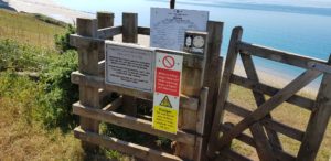 Then it becomes exciting, I go through the firing range, a military training ground. There are no red flags, so it will be fine, I hope. This is much better than the alternative, two kilometers along a fairly busy road without footpath along it. I walk past the shooting ranges and then arrive at Tregantle Fort. This is one of the many forts built around 1860 to defend naval bases against a French attack (that never came).
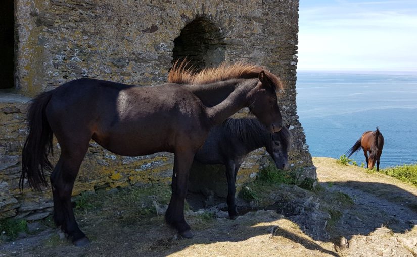
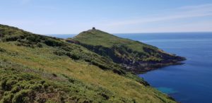 Then it goes towards Rame Head, a headland that I already can see for a while. Once there I make the effort to walk to the top, to the chapel of St Michael the Archangel on Rame Head. The chapel has been there for about 600 years, although the current version was renovated in 1882.
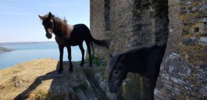 At the top I see that there are ponies walking around. In fact, the ponies have take over the chapel as a shelter. So the chapel has become a sort of pony stable…
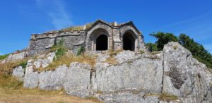 I continue to Penlee Point. Again a chapel or grotto can be admired here. For this I have to go down a bit. It is the chapel / grotto of Queen Adelaide. Originally an 18th century lookout, the chapel / grotto was created and named after Adelaide, a German princess and wife of the Duke of Clarence, who visited it.
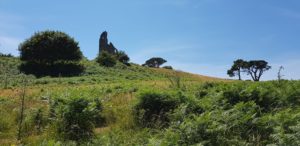 After Penlee Point, a longer forest walk follows to Plymouth, via Cawsand and Kingsand. I come across a real fake ruin, built as a replacement for a navigation obelisk. In the end I walk through old gardens with their own Orangery.
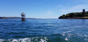 Then it’s time for a ferry again. When I arrive, the ferry is already there. So quickly on board. When arriving at the other side, I am not quite where I expected to be. According to my data, the ferry should have taken me a bit further. No worries, I just walk there and then continue the route. So I do just that. Only to come to the conclusion that I can walk back the same stretch again because that is the route…
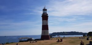


")


 Before I leave, I first make a round through Looe.
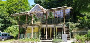 The route now passes
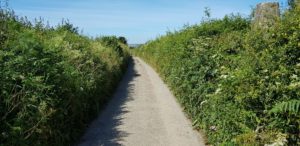
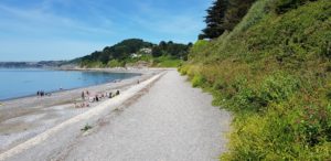 After the coffee I walk the alternative route over the Seaton Sea Wall Walkway and then over the beach. Beach is a big word in this, there is some gray sand, but mainly pebbles and rocks.
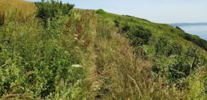 Until Portwrinkle I walk on the usual Coast Path paths. Sometimes narrow and sometimes somewhat wider, sometimes well passable and sometimes overgrown, sometimes right along the cliff edge and sometimes a good deal from the edge, sometimes free and sometimes with barbed wire along it.
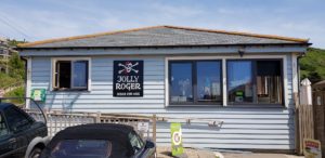 In Portwrinkle I walk along the ‘boulevard’ to the Jolly Roger, the beach café. I have reached my final destination, but not my hotel yet. Still, I think it’s time for a pint.
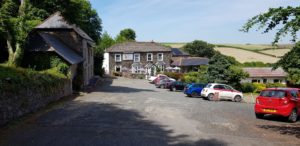 After enjoying my beer, it continues. My hotel is a bit further on, in Crafthole. That turns out to be about a mile away. But the hotel is nicely secluded, between the hills.
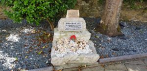
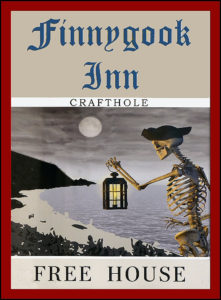 Portwrinkle and Crafthole have their own real ghost,


 Today I walk to Looe, where Ada, the kids and I went on holiday in 2009. But first I have to take the ferry from Fowey to Polruan. This goes fortunately every 15 minutes and when I arrive at the quay, it is already coming.
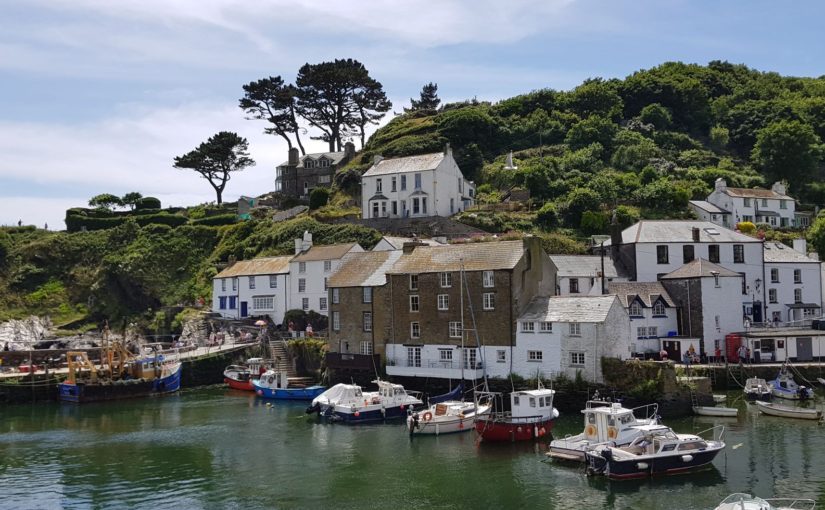
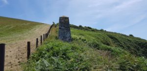 Then it goes to Polperro. It goes up and down to Polperro and occasionally quite steep.
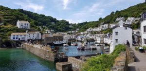 Polperro is again such a village that you only see at the last minute. An ideal opportunity for a break, there is a life band on a stage. So the break will be in the neighborhood in the pub so that I can hear the music, I go for the Blue Peter Inn. A good beer and life music.
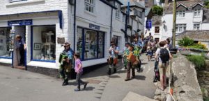 If I go further, I run into a procession. Everyone dressed as a pirate, a kind of brass band in the front and even more musicians at the back. I wait until they have passed and then go on again.
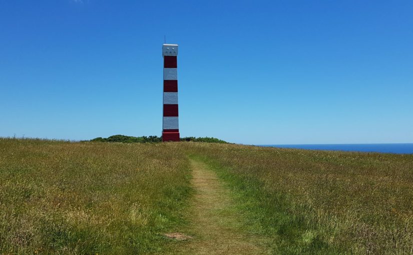
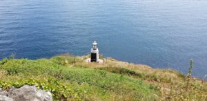 From Polperro I take Reubens Walk as an alternative to the Coast Path. That goes a bit closer to the coast and also comes closer to the mini lighthouse that is here.
 From Talland Bay to Looe is a nice relaxed walk. It takes a while, but then Looe Island comes into view. Then I walk into Looe. Through the suburb and then on to the center.
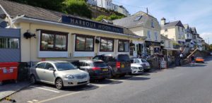 In the center I grab a pint at The Harbor Moon Inn. Here we also ended in 2009 after our walk. We also ate here. The kids wanted a hamburger, but there was only cheeseburger on the menu. So I ordered three cheeseburger without the cheese …


 Just after Charlestown there is a
 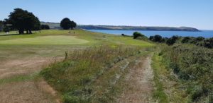 The route to Par is a breeze. Almost flat and for a large part along a golf course. Only the last piece is a bit less interesting. That part is also easy to walk, but not so beautiful. I have to walk around the clay industry.
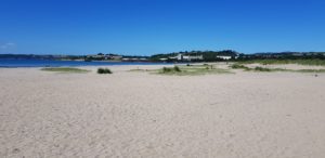 There is little to do on the beach in Par. That may be due to the industry that is just around the corner. In the village itself there are possibilities to have a drink, but I prefer to sit somewhere by the sea.
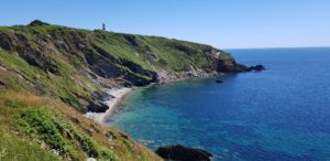 After Polkeris it goes up and down again a number of times, but in general it is also just a nice walk. When I arrive at Gribbin Head, it’s time for biscuits and drinks. We used to do that with the kids when they came from school. I sit on the bench at the day marker on Gribbin Head and enjoy the sun.
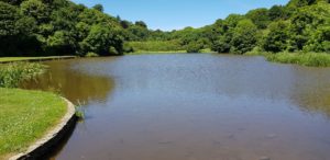 I arrive at Polridmouth Cove and a little later things go wrong. So you walk on an as good as flat sand path in a small forest and a bit ahead a stile appears, a fence that you have to climb over. You look ahead at where you are going and do not pay attention to where you are walking. After all, that was the flat sand path… And then suddenly, spontaneously, a tree root jumps up the path, right in front of my feet! And what do you think? I stumble and go down completely, with my face straight on the path.
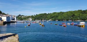


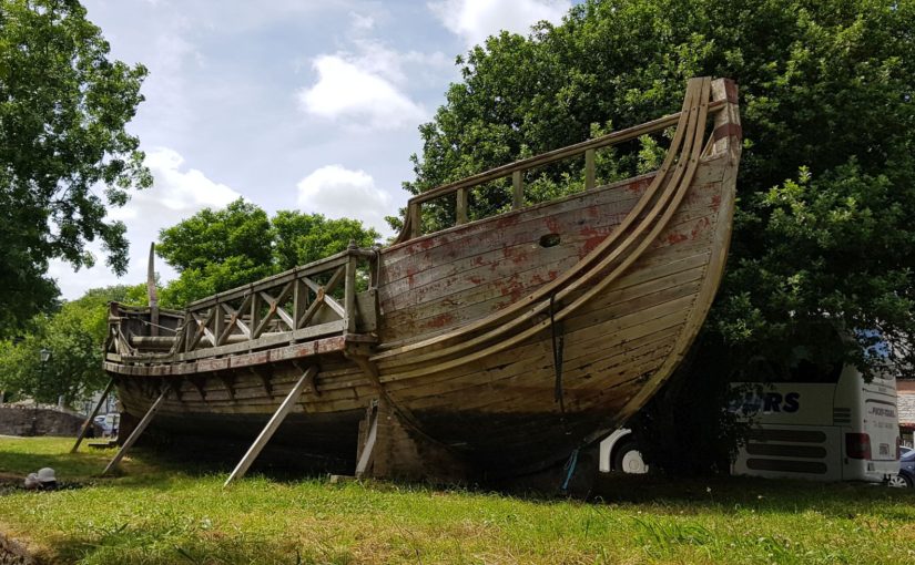
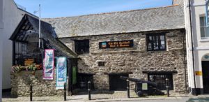
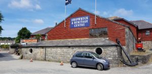 A short but heavy route today. It goes to Charlestown, a picturesque fishing village that is often used in film recordings such as Poldark and (for the elderly among us) The Onedin Line. Here are also some big old sailing ships. I have been here with Ada a long time ago and then with Ada and the kids in 2009. The weather wasn’t very good last time, so we went into the Shipwreck and Heritage Center.
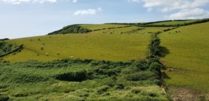
 After the meadows I arrive in Pentewan. This is a small village with a holiday park that is many times larger than the village. Here are the necessary opportunities for a drink, but it is still too early. I am just walking and have traveled less than 5 kilometers. So I go on.
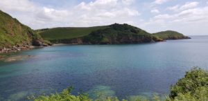 After Pentewan the ‘heavy’ part of the walk starts. It goes down and up steeply a number of times. As far as I’m concerned, it is not that bad, it’s heavy on the legs, but I got used to that. What I find more annoying is that quite a bit goes along some meadows that are very narrow. On the left there is barbed wire and on the right there are shrubs that partly grow on the path. The path itself is a narrow worn track. That means that you have to put your feet right before each other every time and that does not walk easily.
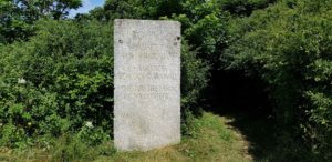 When I arrive at Black Head, I make a diversion to walk to the tip of Black Head. The Coast Path skips this, but since the route is already short today, I can manage a little extra.
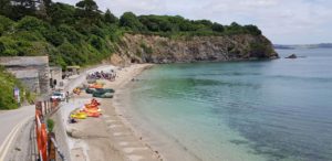 After Black Head it is not done with the steep slopes. It goes down and up again with stairs. Those steps are very uneven, as is normal on the Coast Path.
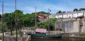 After the break it goes up one more time, via a regular staircase. Then I walk to Charlestown at ease. There I first sit on the terrace for a pint (or two) and then I walk around the harbor in Charlestown. I also walk past the museum that we visited with the kids in 2009.


