Date: 20180521
Time: 9:25 – 14:20
Distance: 22.8 km
Stay: Instow Barton B&B, Instow
Walk
Today an easy route is planned. The distance is not that big, but more important the complete route is flat.
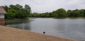
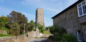
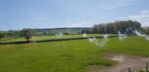
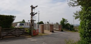 After Braunton I go via a cycle / walking path towards Barnstaple. On the first stretch I first pass a nature reserve and then an army base. The route follows an old railway line and the river, the Taw, to Barnstaple. During this part I meet quite a few other walkers and also cyclists.
In Barnstaple I take a look around and take a short break for a cup of coffee. The museum, which is apparently worth a visit, is closed due to renovations.
 When leaving Barnstaple, there is the possibility to take an alternative route avoiding walking along the busy road. This alternative, however, goes along a very large construction site and does not seem much better. I just follow the standard route. The part along the busy road is not too bad and is very short.
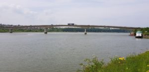
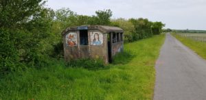 I continue via the Tarka Trail, again along the river Taw, only now on the other side and in the other direction. This part is possibly even more straight than the first stretch of today. It is also a pretty boring part. I can see where I walked this morning (on the other side of the river). Halfway I pass a converted train station, Fremington Station. There is now a tea house. Unfortunately no beer …
On the Tarka Trail there are also other walkers, but many more cyclists.
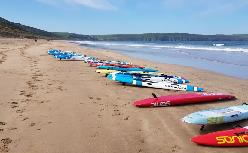
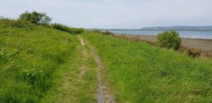 A bit before Instow the path goes more towards the river through a dune-like landscape and fields. That changes into a more industrial, but discarded, area. Via a cricket field I reach Instow. I’m there around 2:20 PM, a little less than 5 hours for a bit more than 20 kilometers, including a break. That is more or less my normal walking pace.
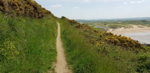
Although today’s route did not excel in terms of views or other sights, it was still a good route to walk. It was mainly about asphalt (bike path), apart from the last part. Especially the absence of any height difference was greatly appreciated by my knees.
The ‘heaviest’ climb of today was to the B & B, which can also be seen in the height graph of today below (note the scale).
In the end I walked about 22 kilometers today to cross a stretch of 6 kilometers as the crow flies (over the Taw).
Weather
It was nice walking weather today. Mainly cloudy, but a nice temperature. However, I noticed that I missed the breeze from the sea today. The past few days that has been constantly present unnoticed. Today it was there only on the very last part at Instow.
Lyric of the day
Because today I’ve only walked along the river, today’s lyrics are from Bruce Springsteen, The River:
I come from down in the valley
where mister when you’re young
They bring you up to do like your daddy done
Me and Mary we met in high school
when she was just seventeen
We’d ride out of this valley down to where the fields were green
We’d go down to the river
And into the river we’d dive
Oh down to the river we’d ride
Then I got Mary pregnant
and man that was all she wrote
And for my nineteenth birthday I got a union card and a wedding coat
We went down to the courthouse
and the judge put it all to rest
No wedding day smiles no walk down the aisle
No flowers no wedding dress
That night we went down to the river
And into the river we’d dive
Oh down to the river we did ride
I got a job working construction for the Johnstown Company
But lately there ain’t been much work on account of the economy
Now all them things that seemed so important
Well mister they vanished right into the air
Now I just act like I don’t remember
Mary acts like she don’t care
But I remember us riding in my brother’s car
Her body tan and wet down at the reservoir
At night on them banks I’d lie awake
And pull her close just to feel each breath she’d take
Now those memories come back to haunt me
they haunt me like a curse
Is a dream a lie if it don’t come true
Or is it something worse
that sends me down to the river
though I know the river is dry
That sends me down to the river tonight
Down to the river
my baby and I
Oh down to the river we ride


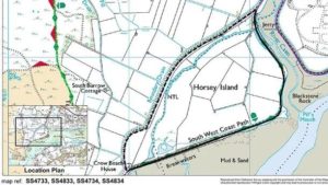 October 25th 2016: The Coast Path is temporarily diverted on Horsey Island south of Braunton (Grid Ref: SS 470 330) due to the sea eroding a large hole in the path making it unsafe. As a result the path is closed and diversion is in place following the toll road (public footpath).


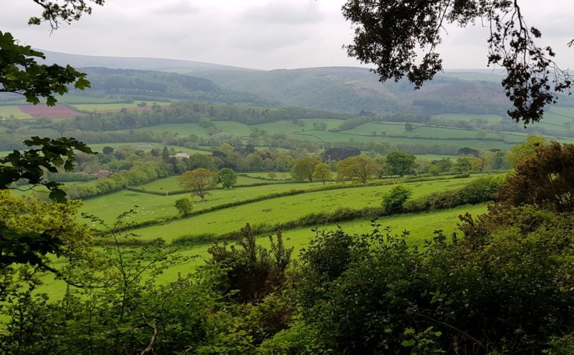
 Up to Ilfracombe the route is not too hard, not too much climbing and fantastic views. I cross a campsite among other things. Also in this first part there are plenty of possibilities to get something to drink (or eat).
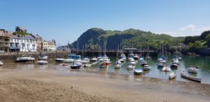 Ilfracombe is full of tourists. Still, I find a quiet terrace (at the back of the restaurant) with a nice view of the sea.
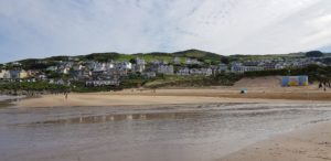
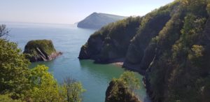
 The part after Ilfracombe is quite heavy again. Not because of the altitude, but because of the many falls and rises. Eventually I arrive at Morte Point, a rock formation that protrudes into the sea. From here the beaches of Woolacombe are clearly visible. It is not very far anymore to Woolacombe. That last part, however, is still quite hard because it is going up steeply before I am on the road and then it goes down again.
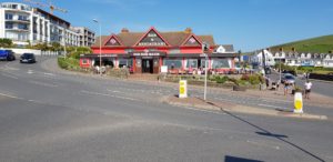 At the end, however, the Red Barn Inn (very very red) waits with a nice selection of beers …
 Today it was again great weather, sunny and sometimes even a bit too hot. Somewhat the same as yesterday, only slightly warmer. No jacket needed today.


 Today starts well, I save myself the first climb by going up the
 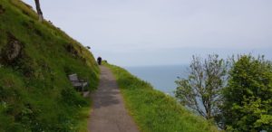 After that the path goes along the hills and along the sea. There are a lot of walkers here. But the crowd is getting less after a while. I arrive at the Valley of Rocks. Here I go up to enjoy the view. Then the path continues past Lee Abbey. The path now runs along a road, but there is an alternative route more closely to the coast and through the meadows. Of course I choose this.
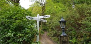 At the bottom, there is a sign indicating the directions to America, Russia, Iceland and New Zealand. Here I meet the three hikers again and we have a chat and the some jokes about the signpost. Then I continue, they have a slightly slower pace. Later I will meet the three musketeers again.
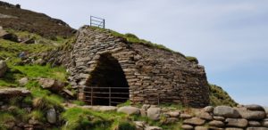 After quite some time I arrive at Heddon Valley. Here I first walk to Heddon Beach. There is an ancient lime kiln on the beach. When I am back on the path, I meet the three musketeers again, they are resting on a bench. We have another chat and then I continue to the Hunter’s Inn. I follow the river, the Heddon, and after a small detour (the path to the inn is closed because a big tree has fallen down or is cut down) I arrive at my resting place.
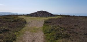 Eventually it goes all the way down again. I cross a stream and after that it goes up steeply, as usual, to Great Hangman this time. Fortunately, the steep stretch does not last too long and the rest of the climb to Great Hangman goes much more gradually. Great Hangman is the highest sea cliff in England and thus also the highest point on the South West Coast Path (318m).
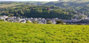 The descent is pretty heavy. I feel my left knee protesting. In the end, however, we all end up in Combe Martin. Now quickly to the B & B for a shower and then into the village for something to eat.


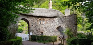 Worthy Toll House, a beautifully designed toll house that has been preserved very well.
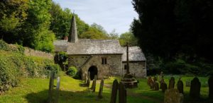 Culbone Church, one of the smallest churches in England (10.5 x 3.6 meters) where regular services are still being held. Around the church is an old cemetery. This looks great.
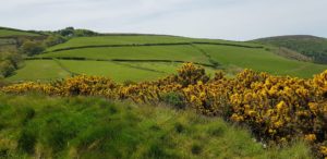 Sugerloaf hill, a small diversion with a very nice view. Here I have a break to eat and drink and to enjoy the view.
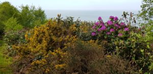 Rhododendrons, to the yellow gorse, the purple Rhododendron joins at one point. Not an occasional shrub, but whole mountain slopes. A great view with all those colors.
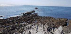
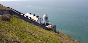 Foreland, here at Devon’s northernmost point there is a lighthouse and of course I walk there. Further on there is also a possibility to walk to the top of the hill. From here there is a great view in all directions.


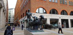
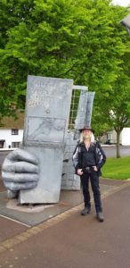 Then back to the beginning of the path. Here I ask another hiker if he wants to take a picture of me and the sculpture. This is more or less obligatory when you walk the South West Coast Path 🙂
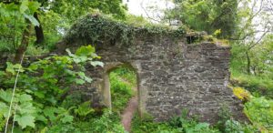 Once back on the path, it goes up a little further to North Hill Viewpoint. Here I have a nice view. Just a pity that it is very cloudy.
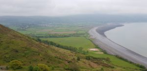 At the top, I meet a Danish woman who is listening carefully. She makes recordings of the tides and is looking for the best point to do so. We chat for a while and after I walk a bit further to the rocky point, I go down through the bushes on a very steep path. The path is so narrow and overgrown that I regularly doubt whether there is a path at all. But every time a route shows as I continue.
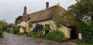 Eventually I end up on the South West Coast Path again. The next part is a relaxed track along a small stream. At Bossington I cross the stream and it’s time for a break at the famous
 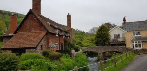 Because I am in Bossington well in time, I decide to do an extra walk inland to Allerford and Selworthy. This is also a very nice route with nice views on the hills in this area. Both villages are very small and picturesque with a number of nice cottages. In Selworthy I walk to the church with a very old cemetery. Most tombstones are hardly or not legible anymore.
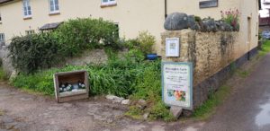 On the outskirts of Bossington, at Bossington Farm, I buy a bottle of natural apple juice at the side of the road. My water starts to run out and natural apple juice seems a nice replacement to me. It actually is and the next few miles I empty the bottle.
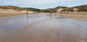
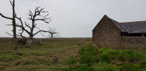 The next miles go through the Marsch, an area that regularly floods at high tides. This is actually a little boring. However, there are some impressive dead trees. Eventually I come all the way to the coast and there the path goes over stones. This is not nice walking and I am happy when I can go up to the road.
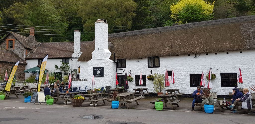 Just a little bit further along the road and I reach Porlock Weir. I’m looking for


 After I checked out, I walked to Paddington station. Fortunately that was only a short walk (with my heavy bags). I arrived at the station well in time. My Super Off Peak ticket was only valid after 10 am, so I let the first train to Taunton pass. I therefore had ample time to observe the people at the busy station. Travelers in a state varying from relaxed to blind panic.
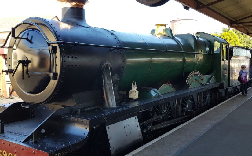
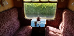 The steam train,
 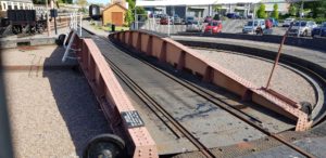 When I arrive in Minehead, I have a short break at the Turntable cafe for another local beer and something small to eat. They have a train turntable here (hence the name of the cafe). Unfortunately they have already used it today and are now closing down. Still nice to see. It is also nice to see how all the volunteers work for their railway, from the conductor and the driver to the station chiefs. For most of them it is not just a hobby, but very serious.
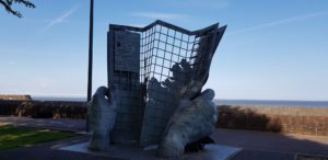 After this arrival in style, I have to walk one more kilometer with my heavy bags (I gradually am beginning to see the advantage of wheels on one’s suitcase). Tonight I will be staying in
 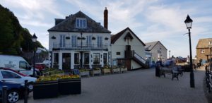 At The Old Ship Aground I can work on this blog on the terrace with a nice IPA after a well-deserved shower.
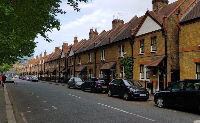
 Everything goes smoothly after that. I have to wait a little more than an hour in Brussels. Then the Eurostar takes me to London in time (just after 14:00 local time).
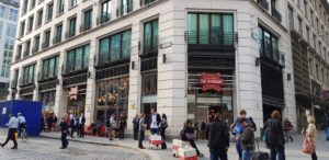
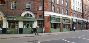
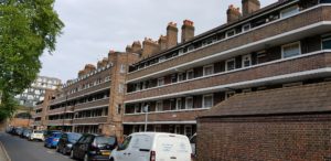 Because I am in London well in time, I decide to go for a walk. It is nice walking weather, sunny, dry and warm.
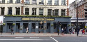
 For that I have to walk 23 kilometers.
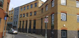
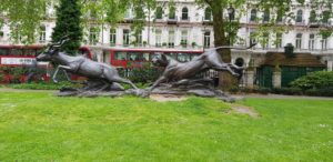 There is a lot of (re)building going on in London. I try to walk as much as possible through back alleys and to avoid the tourist routes. That results in a number of nice pictures.